Difference between revisions of "2009-04-17 50 10"
From Geohashing
imported>Reinhard (New page: {{meetup graticule | map=<map lat="50" lon="10" date="2009-04-17" /> | lat=50 | lon=10 | date=2009-04-17 }} Text ---Reinhard === Awards === {{Bicycle geohash | latitu...) |
imported>Reinhard m |
||
| Line 11: | Line 11: | ||
| − | === | + | <gallery caption="Photo Gallery" widths="200px" heights="200px" perrow="2"> |
| − | + | Image:20090417-50N10E-01.jpg| Manu walking on one of the better forest tracks. | |
| − | | | + | Image:20090417-50N10E-02.jpg| Manu climbing down down to the hashpoint. |
| − | | | + | Image:20090417-50N10E-03.jpg| Proof of reached coordinates. GPS accuracy bad and drifting a little. |
| − | | | + | Image:20090417-50N10E-04.jpg| Grünik is proud of reaching his first geohash. |
| − | | | + | Image:20090417-50N10E-05.jpg| Reinhard, Grünik, Manu and Krokmodon happy at the hashpoint. |
| − | + | Image:20090417-50N10E-06.jpg| Dark forest at the hashpoint. | |
| + | </gallery> | ||
[[Category:Expeditions]] | [[Category:Expeditions]] | ||
[[Category:Coordinates reached]] | [[Category:Coordinates reached]] | ||
Revision as of 19:58, 18 April 2009
| Fri 17 Apr 2009 in 50,10: 50.5152987, 10.6611671 geohashing.info google osm bing/os kml crox |
Text
---Reinhard
- Photo Gallery
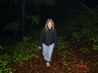
Manu walking on one of the better forest tracks.
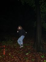
Manu climbing down down to the hashpoint.
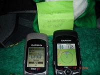
Proof of reached coordinates. GPS accuracy bad and drifting a little.
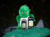
Grünik is proud of reaching his first geohash.
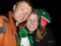
Reinhard, Grünik, Manu and Krokmodon happy at the hashpoint.
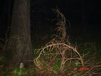
Dark forest at the hashpoint.


