Difference between revisions of "2009-04-18 52 7"
imported>Arvid (storrrrry) |
(2005) |
||
| Line 6: | Line 6: | ||
}} | }} | ||
| − | = | + | qTF0QX <a href="http://yjpcsnkfgiaw.com/">yjpcsnkfgiaw</a>, [url=http://cdmdcnlayxkl.com/]cdmdcnlayxkl[/url], [link=http://gcgfodpqjjos.com/]gcgfodpqjjos[/link], http://uikndecwkmpq.com/ |
| − | |||
| − | |||
| − | |||
| − | |||
| − | |||
| − | |||
| − | |||
| − | |||
==Achievements== | ==Achievements== | ||
Revision as of 07:51, 5 February 2010
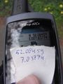
| Sat 18 Apr 2009 in 52,7: 52.0845888, 7.8377370 geohashing.info google osm bing/os kml crox |
qTF0QX <a href="http://yjpcsnkfgiaw.com/">yjpcsnkfgiaw</a>, [url=http://cdmdcnlayxkl.com/]cdmdcnlayxkl[/url], [link=http://gcgfodpqjjos.com/]gcgfodpqjjos[/link], http://uikndecwkmpq.com/
Achievements
Expedition
It was a bit cold in the morning, so when I left home at 9:05 I was wearing long tights and a jacket. At 11:20 I stopped to change pants and take the jacket off. I realized I left my sun lotion at home. It was very sunny and sunset is around 20:00. Nine hours in the sun will destroy my skin. Luckily I know that every German with a church and a pub also has a Schlecker, which is a drugstore. And since it was still well before noon it would also still be open!
At 11:45 I arrived in Riesenbeck where there was indeed a Schlecker. I bought sunprotectlotion and muesli bars. From here on the hills start. Around noon I left Riesenbeck. Everything went fairly good. There were two 25% descends (or that was what the sign claimed). Those are scary. Pull the brakes from the start and pray they'll hold. The second was a walking route and not a cycling route, and it had gravel bits. My rear wheel started to slip and bounce a bit, but I survived.
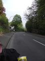
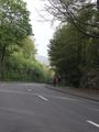
The hill to Tecklenburg started to be annoying. I was very hot and sweaty when I finally made it, and of course there's and immediate descend that cooled me off, probably a bit too much. From there I decided to go to Lengerich and on to the hash, so I would be there at 4pm. I managed that, but I was cold and nauseous.
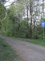
The hash was at a dead end road leading to a house/farm. Nothing special there. I went back to Lengerich and from there on I would decide what I was going to do. I know Lengerich from the trip where I strained my ankle, I took the train from there then. I also know it was still 70km from there to home, shortest route. I cycled to the train station to see whether the pub against it was open. Sadly it wasn't. I noticed the phonebooth, since Ekorren mentioned one having the wrong color somewhere. I guess this was one of the newer ones. And a bit further there was one of the older types, but in the correct color. Only at home I found out the car in that picture has a Dutch license plate.
So, what was I going to do? I sure wasn't going to finish the Hillroute, but would I take the shortest route home, or take the way back to Riesenbeck as the route suggested? Since I didn't plan the short route and I was feeling slightly better, I went for the latter.
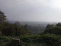
Except for the bit back into Tecklenburg that was fairly easy. I was rewarded with a broad view though, although it was a bit foggy/smoggy in the valley. And after that I set a new speed record: 80.00km/h downhill. The road was nice and I had a ladybird exploring my GPS.
After that it was just going on to get home. One more remarkable thing though: there was a cat in the middle of the bikelane, probably interested in some other animal, when it noticed me. It just stared how I approached at 28km/h or so, right at it. I steered past it, and at that moment it went through it's knees, like something would fly over or something (which I did, of course). I guess Darwin will take care of this cat next time. I arrived home at 21:05.
Tractor spraying... dust.
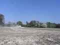
Really. I hope it doesn't kill me.
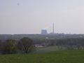
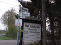
Typical german landmark.
Success!
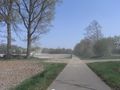
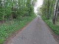
X marks the spot. Bike in the background.
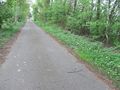
X marks the spot. I came from there.

Happy hasher with sunlotion on his face.
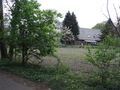
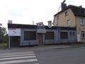
House just south of the hash. (nr24)

Hasher that used camera as mirror.

Really! With the faces and everything.
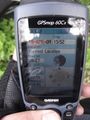
Time&date.
The hash was on the road to 23.
It was a dead end according to this sign.
Historical, see story.
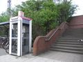
Phone booth and stairs to traintracks.
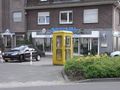
Another phone booth in Lengerich. Hey. That's a dutch numberplate.
I came from down there.
I mean there. The sign says 12%
And just 100m further there was this viewpoint.
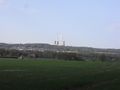
Landmark from the other side.
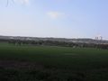
Wider view.
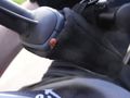
Ladybird. This was the best of 5 tries to make a proper picture of it. Of course I didn't stop cycling because of it.
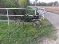
The bike! I nearly forgot to take a picture of it.


