Difference between revisions of "2009-04-24 48 11"
imported>Zb m |
imported>Zb (Cont'd.) |
||
| Line 1: | Line 1: | ||
| + | {{meetup graticule | ||
| + | | map=<map lat="48" lon="11" date="2009-04-24"/> | ||
| + | | lat=48 | ||
| + | | lon=11 | ||
| + | | date=2009-04-24 | ||
| + | }} | ||
| + | |||
===Plans=== | ===Plans=== | ||
| − | Very similar to [[2009-04-03 48 11]], which I enjoyed a lot. Depending on my work situation, I might give it a try. Possible ETA 6:50p (local).--[[User:Zb|Zb]] 20:03, 23 April 2009 (UTC) | + | Very similar to [[2009-04-03 48 11]], which I had enjoyed a lot. Depending on my work situation, I might give it a try. Possible ETA 6:50p (local).--[[User:Zb|Zb]] 20:03, 23 April 2009 (UTC) |
===Expedition=== | ===Expedition=== | ||
| Line 35: | Line 42: | ||
How the times have changed. I was here exactly three weeks ago, almost at the same minute of the day. The canola (rapeseed) has become way longer, the shadows, in turn, are now way shorter. Since both pictures were taken around 6:30p, the sun was almost exactly West of the spot when I took either picture, casting the shadows in very similar directions. | How the times have changed. I was here exactly three weeks ago, almost at the same minute of the day. The canola (rapeseed) has become way longer, the shadows, in turn, are now way shorter. Since both pictures were taken around 6:30p, the sun was almost exactly West of the spot when I took either picture, casting the shadows in very similar directions. | ||
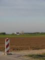
| − | There's a small airport in Jesenwang. | + | There's a small [http://de.wikipedia.org/wiki/Flugplatz_Jesenwang airport in Jesenwang]. |
<gallery> | <gallery> | ||
Image:2009-04-24 geo zb 0011.jpg|The airport is on the hill, right above the horses. | Image:2009-04-24 geo zb 0011.jpg|The airport is on the hill, right above the horses. | ||
| Line 64: | Line 71: | ||
Image:2009-04-24 geo zb 0033.jpg|POSTED: Baindlkircher Rocknächte. | Image:2009-04-24 geo zb 0033.jpg|POSTED: Baindlkircher Rocknächte. | ||
</gallery> | </gallery> | ||
| + | |||
| + | But this isn't serious partying, this is serious geohashing. Leaving Jesenwang on its South end towards the location: | ||
| + | <gallery> | ||
| + | Image:2009-04-24 geo zb 0032.jpg|Jesenwang. Kids do not go together well with drivers who push the pedal to the metal. | ||
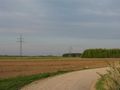
| + | Image:2009-04-24 geo zb 0020.jpg|The coordinates are right in the middle of this picture. | ||
| + | </gallery> | ||
| + | |||
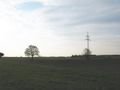
| + | The power line right next to the coordinates is somewhat unusual: There's both a 50 Hz, three-phase system for the public electricity grid and a 16.67 Hz, single-phase system for the railway grid ''on the same pylons''. Like, ''wow!'' | ||
| + | <gallery> | ||
| + | Image:2009-04-24 geo zb 0021.jpg|Lines for the public grid and the railway grid usually don't share their pylons. | ||
| + | Image:2009-04-24 geo zb 0023.jpg|Sign for the three-phase system. | ||
| + | Image:2009-04-24 geo zb 0022.jpg|Sign for the single-phase railway system. | ||
| + | </gallery> | ||
| + | Since the power generation and distribution systems have been sold by the state and turned into private companies just like the railway system, it's wrong, strictly speaking, to still call the three-phase system 'public', but the sign for the railway system doesn't care either: It still says Deutsche ''Bundes''bahn and not Deutsche Bahn ''AG''. | ||
| + | |||
| + | Closing in on the coordinates. | ||
| + | <gallery> | ||
| + | Image:2009-04-24 geo zb 0024.jpg|Springtime is awesome. | ||
| + | Image:2009-04-24 geo zb 0025.jpg|POSTED: Don't sh!t where you eat. | ||
| + | </gallery> | ||
| + | |||
| + | Success! The very exact spot was on a field that I didn't want to walk on because it looked like seeds had just been put in, but I'll still count this one. | ||
| + | <gallery> | ||
| + | Image:2009-04-24 geo zb 0028.jpg|The No-Batteries Geohashing Device reads (almost) zero, as you can clearly see in this picture. | ||
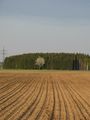
| + | Image:2009-04-24 geo zb 0026.jpg|Looking NW of 48.1548551, 11.1314059. | ||
| + | Image:2009-04-24 geo zb 0027.jpg|Looking NE of 48.1548551, 11.1314059. | ||
| + | </gallery> | ||
| + | |||
| + | Good-bye, 48.1548551, 11.1314059. | ||
| + | <gallery> | ||
| + | Image:2009-04-24 geo zb 0030.jpg|The evening sun makes everything look very nice. | ||
| + | Image:2009-04-24 geo zb 0031.jpg|St. Willibald, 500m E of Jesenwang. | ||
| + | Image:2009-04-24 geo zb 0034.jpg|The approximate coordinates of this geohash were already very relevant long before GPS or the internets were invented. I doubt the romans had already used as many sings as today's travellers do. | ||
| + | </gallery> | ||
| + | |||
| + | |||
MORE TO COME. STILL IN PROGRESS. | MORE TO COME. STILL IN PROGRESS. | ||
Revision as of 19:58, 25 April 2009
| Fri 24 Apr 2009 in 48,11: 48.1548551, 11.1314059 geohashing.info google osm bing/os kml crox |
Plans
Very similar to 2009-04-03 48 11, which I had enjoyed a lot. Depending on my work situation, I might give it a try. Possible ETA 6:50p (local).--Zb 20:03, 23 April 2009 (UTC)
Expedition
UPDATE STILL IN PROGRESS...
Zb's expedition was a walk of three hours, from and back to the train station in Mammendorf that's on the way of my daily commute.
This train took me to Mammendorf after work:
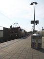
Class 111.

Most of the walk was along the same path I took on a previous geohash: 2009-04-03 48 11
I had planned to not take as many pictures in Mammendorf as last time, but there was stuff that soon made me change my mind. Maybe it's just me, but I really do think you don't need much fantasy to figure out why this piece of art is extremely weird:
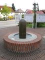
Art in front of Mammendorf's town hall. Note the water outlet on top.

Holy crap, what were the artist and the community board thinking when making and POSTING this thing (cf. Image talk:2009-04-16 48 -122 otherwise posted.jpg for POSTED)? I think the most ironic part is that it says No drinking water on the sign. Who would drink stuff that comes out of a thing shaped like this anyway?
Only some advertising posters were even more explicit (or stupid, or both):
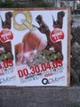
Don't blame Mammendorf. This ad is for a club in Munich.
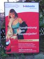
When you buy their heating system for your car, she's yours.


Anyhow, on to Jesenwang. I came along the exact spot of my last successful geohash on 2009-04-03 48 11.
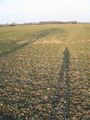
Geohash on 2009-04-03. The spot is where the shadows would meet, if they were longer.
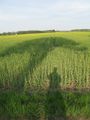
Same Time, same place. Spring has hit the auto color enhancement button.


How the times have changed. I was here exactly three weeks ago, almost at the same minute of the day. The canola (rapeseed) has become way longer, the shadows, in turn, are now way shorter. Since both pictures were taken around 6:30p, the sun was almost exactly West of the spot when I took either picture, casting the shadows in very similar directions.
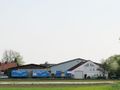
There's a small airport in Jesenwang.
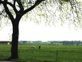
The airport is on the hill, right above the horses.
Jesenwang Airport.


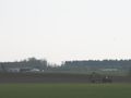
Also, some planes that go to Munich's airport fly through the area. Thus, there's a lot of stuff in the air.
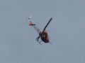
Aircraft.
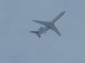
Aircraft.
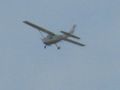
Aircraft.
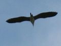
Aircr... No: Wildlife.
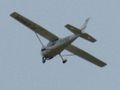
Aircraft.
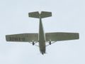
Aircraft. D-EMOE was there a lot.


Jesenwang. According to both the words on this moving company's trucks and to an ad for Bavarian milk, Jesenwang is where both boys and men are strong. I couldn't find any POSTED information about females in this town, so I can't really figure out how Jesenwang and Lake Wobegon compare, the latter having nothing but strong women, good looking men and children above average.
POSTED: Local milk (NOT beer!) grows strong Bavarians.
"Die kräftigen Männer".


A comparison with the way how women are pictured on the ads in Mammendorf, however, would give yet another good reason why good ol' gender studies are still important in 2009.
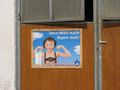
If the aim of the mission would have been serious partying, I definitely came on the wrong weekend. The MEGAPARTIES are posted for either last Friday or next Thursday. As far as seeing Signs or FACE rocking the hell out of nearby Baindlkirchen, I had no luck either.
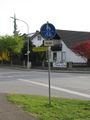
POSTED: MEGAPARTY.

POSTED: Baindlkircher Rocknächte.


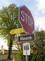
But this isn't serious partying, this is serious geohashing. Leaving Jesenwang on its South end towards the location:
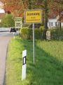
Jesenwang. Kids do not go together well with drivers who push the pedal to the metal.
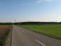
The coordinates are right in the middle of this picture.


The power line right next to the coordinates is somewhat unusual: There's both a 50 Hz, three-phase system for the public electricity grid and a 16.67 Hz, single-phase system for the railway grid on the same pylons. Like, wow!
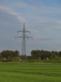
Lines for the public grid and the railway grid usually don't share their pylons.
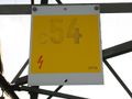
Sign for the three-phase system.
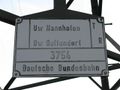
Sign for the single-phase railway system.


Since the power generation and distribution systems have been sold by the state and turned into private companies just like the railway system, it's wrong, strictly speaking, to still call the three-phase system 'public', but the sign for the railway system doesn't care either: It still says Deutsche Bundesbahn and not Deutsche Bahn AG.
Closing in on the coordinates.
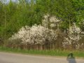
Springtime is awesome.
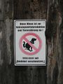
POSTED: Don't sh!t where you eat.


Success! The very exact spot was on a field that I didn't want to walk on because it looked like seeds had just been put in, but I'll still count this one.
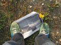
The No-Batteries Geohashing Device reads (almost) zero, as you can clearly see in this picture.
Looking NW of 48.1548551, 11.1314059.
Looking NE of 48.1548551, 11.1314059.


Good-bye, 48.1548551, 11.1314059.
The evening sun makes everything look very nice.
St. Willibald, 500m E of Jesenwang.
The approximate coordinates of this geohash were already very relevant long before GPS or the internets were invented. I doubt the romans had already used as many sings as today's travellers do.


MORE TO COME. STILL IN PROGRESS.