Difference between revisions of "2009-06-12 32 -110"
imported>Wyle & RoadRunner (New page: {{meetup graticule | map=<map lat="32" lon="-110" date="2009-06-12" /> | lat=32 | lon=-110 | date=2009-06-12 | graticule_name=Tucson | graticule_link=Tucson, Arizona}} == Expeditions == Wi...) |
imported>FippeBot m (Location) |
||
| Line 26: | Line 26: | ||
[[Category:Expeditions with photos]] | [[Category:Expeditions with photos]] | ||
[[Category:Coordinates reached]] | [[Category:Coordinates reached]] | ||
| + | {{location|US|AZ|CH}} | ||
Revision as of 03:52, 8 August 2019
| Fri 12 Jun 2009 in Tucson: 32.1575185, -110.2913042 geohashing.info google osm bing/os kml crox |
Expeditions
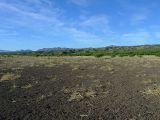
Wishing RoadRunner was here. I had to stop for gas, snacks and a drink before heading east after leaving the Casa Grande hash point. Drive was easier than expected since the whole road to the location was paved. Tucson Hash point was actually in the middle of a circular crop irrigation field ... not to be confused with a crop circle. I expected to be carefully trudging through a wheat or alfalfa field, but it had been grazed to the dirt. One gate to hop and some scrambling through thorny mesquite trees put me on an easy walk to the hash. Back out the way I came. Hoping over some thorny dead mesquite branches and a multihash is done. Until ...
I get back home and there's no cell phone in the car. OK, call it from another phone. Dead silence and the ringer volume is set high. CRAP. I used it on the way to the irrigation field and that is the only place I got out of the car since then. Its 8pm, the sun is setting and that field is 65 miles from the house. Replacement isn't cheap nor simple to reload contact info, so I'm back on the road. Three possibilities. It fell out of the car when I got out; it fell out of my pocket when I hopped the gate; it jumped out of my pocket when I was hopping through the brush.
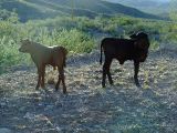
I get back to the field with GPS and flashlight in hand. Walk to where I parked the first time. No phone. Look around the gate. No phone visible. Time to call it from a second cell phone and listen. Wonderful. No service. Look a little closer. Nope. No phone here. Time to hop the fence and start retracing my path. After about 20 minutes of checking the GPS, searching the ground, checking the GPS, searching ... there it was. Right where I had hopped through the thorny brush. Did I mention that the dozens of thorny brush patches all looked alike?! Back through the mesquite trees, back over the gate, back in the car, and back on the road home ... along with a dozen cows here and there who try to avoid the car ... by walking down the middle of the road. They finally decide to head to the shoulder and I'm on my way. Quick stop for a sandwich and I finally get home (WITH GPS, CELL PHONE, CAMERA, ETC) at 11pm.
Geohashing is about adventure and today was certainly that.
RoadRunner missed an eventful one.


