Difference between revisions of "2009-06-22 50 11"
imported>Reinhard m (same horrible mistake) |
imported>Reinhard (today's hash report) |
||
| Line 9: | Line 9: | ||
[[User:Reinhard|Reinhard]] will definitely show up there in the evening after work, since it's only 5 km from his home and at a probably easily reachable point in a small forest. | [[User:Reinhard|Reinhard]] will definitely show up there in the evening after work, since it's only 5 km from his home and at a probably easily reachable point in a small forest. | ||
| + | |||
| + | |||
| + | == Mud, nettles and angry cows == | ||
| + | |||
| + | I thought today's hash would nearly become an easy hash. It didn't. Originally, I thought I'd go for my first [[Walk geohash]], but then Manu told me I wasn't constructed to walk and I had to admit that she was right, so finally I set out for the expedition by bike once again. When I stepped through the front door, it began to rain, but it cycling 6 km throug the rain couldn't be that bad. In fact, the rain wasn't too bad and soon I came to the small rectangular forest, where the hashpoint was located. I could ride on a field path at the edge of the forest until I got closest to the hashpoint and dived right into the wood. I could use a much worse path there .. very muddy with 1 m high plants (mainly nettles) in the middle of it. I couldn't cycle on this one, so I pushed the bike, later carried it, because even while pushing it picked up too much mud. The hashpoint itself lay right beside the path, maybe 5 m, so I made my way through even higher nettles and hurried making some photos with my little companions Schnauzi, Roosevelt and Eisi. | ||
| + | |||
| + | The opposite side of the forest was closer, so I tried to go back there, even though there was no path plotted on my topographic map. The map was right and I ended up at a meadow with tens of cows, surrounded by an electrical fence. I tried to walk along this fence, back towards the road, for some ten meters, when suddenly the cows started running directly to me. Immediately, I stopped, which made them go slower, but didn't stop them. I thought, this might be the right time to turn around, did that, but still had to hurry to get back in the wood, before they were standing close to me. Doing that, I noticed, that there really was high voltage at the electrical fence (me or the bike must have touched it), which slowly made me calm down. In deed, the crowd of cows stopped at the fence, still keeping an eye on me, when I was taking the long, muddy way back through the wood. After leaving the wood and cleaning the space between tires and forks with the help of a stick, the rest was almost boring. | ||
| + | |||
| + | ---[[User:Reinhard|Reinhard]] | ||
| + | |||
| + | <gallery caption="Photo Gallery" widths="200px" heights="200px" perrow="2"> | ||
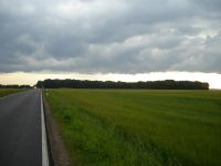
| + | Image:20090622-50-11-01.jpg|The little destination forest as seen from the road to Vierzehnheiligen. | ||
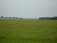
| + | Image:20090622-50-11-02.jpg|I could see the village Cospeda, where I live, from the same point. So it was really close. | ||
| + | Image:20090622-50-11-03.jpg|Why does it always have to end like this? | ||
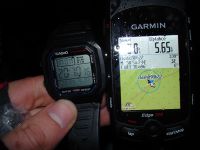
| + | Image:20090622-50-11-04.jpg|Coordinates reached. | ||
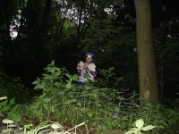
| + | Image:20090622-50-11-05.jpg|My little companions Schnauzi, Roosevelt and Eisi and me at the hashpoint. (I really have to get me a tripod!) | ||
| + | Image:20090622-50-11-06.jpg|Angry cows from a reasonably safe distance. They're still frightening me. | ||
| + | </gallery> | ||
[[Category:Expedition planning]] | [[Category:Expedition planning]] | ||
| + | [[Category:Expeditions]] | ||
| + | [[Category:Expeditions with photos]] | ||
| + | [[Category:Coordinates reached]] | ||
Revision as of 20:00, 22 June 2009
| Mon 22 Jun 2009 in 50,11: 50.9707392, 11.5116012 geohashing.info google osm bing/os kml crox |
Plans
Reinhard will definitely show up there in the evening after work, since it's only 5 km from his home and at a probably easily reachable point in a small forest.
Mud, nettles and angry cows
I thought today's hash would nearly become an easy hash. It didn't. Originally, I thought I'd go for my first Walk geohash, but then Manu told me I wasn't constructed to walk and I had to admit that she was right, so finally I set out for the expedition by bike once again. When I stepped through the front door, it began to rain, but it cycling 6 km throug the rain couldn't be that bad. In fact, the rain wasn't too bad and soon I came to the small rectangular forest, where the hashpoint was located. I could ride on a field path at the edge of the forest until I got closest to the hashpoint and dived right into the wood. I could use a much worse path there .. very muddy with 1 m high plants (mainly nettles) in the middle of it. I couldn't cycle on this one, so I pushed the bike, later carried it, because even while pushing it picked up too much mud. The hashpoint itself lay right beside the path, maybe 5 m, so I made my way through even higher nettles and hurried making some photos with my little companions Schnauzi, Roosevelt and Eisi.
The opposite side of the forest was closer, so I tried to go back there, even though there was no path plotted on my topographic map. The map was right and I ended up at a meadow with tens of cows, surrounded by an electrical fence. I tried to walk along this fence, back towards the road, for some ten meters, when suddenly the cows started running directly to me. Immediately, I stopped, which made them go slower, but didn't stop them. I thought, this might be the right time to turn around, did that, but still had to hurry to get back in the wood, before they were standing close to me. Doing that, I noticed, that there really was high voltage at the electrical fence (me or the bike must have touched it), which slowly made me calm down. In deed, the crowd of cows stopped at the fence, still keeping an eye on me, when I was taking the long, muddy way back through the wood. After leaving the wood and cleaning the space between tires and forks with the help of a stick, the rest was almost boring.
---Reinhard
- Photo Gallery


