Difference between revisions of "2009-08-02 49 -114"
imported>Elbie (more) |
imported>Elbie (→Expedition: all the photos) |
||
| Line 11: | Line 11: | ||
* [[User:Elbie|Elbie]] and her parents. | * [[User:Elbie|Elbie]] and her parents. | ||
| − | ==Expedition== | + | ==Illustrated Expedition== |
| − | <gallery> | + | <gallery widths="300px" heights="200px" perrow=2 > |
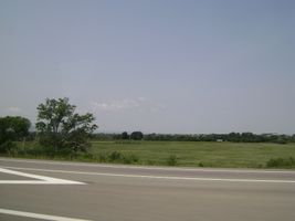
Image:2009-08-02 49 -114 smallCoulee.jpg | I set out with my parents in their car around 13:00. The terrain began pretty much like this: farms, with the occasional coulee. | Image:2009-08-02 49 -114 smallCoulee.jpg | I set out with my parents in their car around 13:00. The terrain began pretty much like this: farms, with the occasional coulee. | ||
Image:2009-08-02 49 -114 prairie.jpg | Mostly, though, it was flat. | Image:2009-08-02 49 -114 prairie.jpg | Mostly, though, it was flat. | ||
| Line 33: | Line 33: | ||
Image:2009-08-02 49 -114 soClose.jpg | Closest we could get was about 200 metres. | Image:2009-08-02 49 -114 soClose.jpg | Closest we could get was about 200 metres. | ||
Image:2009-08-02 49 -114 hashpoint.jpg | The hashpoint would be where the trees are. Beyond it are Angus cattle (future steaks), and windmills. | Image:2009-08-02 49 -114 hashpoint.jpg | The hashpoint would be where the trees are. Beyond it are Angus cattle (future steaks), and windmills. | ||
| + | Image:2009-08-02 49 -114 elbieDidntTrespass.jpg | Excitement about getting this far quickly turned into... | ||
| + | Image:2009-08-02 49 -114 noTrespassingForElbie.jpg | ...disappointment about not getting to go all the way. | ||
| + | Image:2009-08-02 49 -114 noTrespassingForDad.jpg | Dad wanted to get to the point too. | ||
| + | Image:2009-08-02 49 -114 paperAirplane.jpg | We came unprepared for a proxy hash, but would that stop a physicist? | ||
| + | Image:2009-08-02 49 -114 badLanding.jpg | The wind, however, would. The plane didn't fall close enough for a proxyhash to be successful. | ||
| + | Image:2009-08-02 49 -114 paperBall.jpg | My mother proposes another approach to surpassing the wind, which was blowing from the hashpoint. It did not get much further. | ||
| + | Image:2009-08-02 49 -114 albertaCoatArms.jpg | And so, we set off to try and find the owners of the ranch. And by the way, Alberta is probably the only region I know of whose [http://www.canadianbeauts.faketrix.com/images/coatofarms/OriginalFiles/Alberta-coat-of-arms.jpg coat of arms] looks wonderfully representative of its physical geography. Anyway, we talked to the ranch owner's friendly neighbours and found out that this would not be an Ambassadorhash. Alas. | ||
| + | Image:2009-08-02 49 -114 moose.jpg | So, we went off to find another picnic location. We found a moose at this one. | ||
| + | Image:2009-08-02 49 -114 tableMountain.jpg | Table Mountain. | ||
| + | Image:2009-08-02 49 -114 anotherMt.jpg | More of the Rockies as we searched for a consolation picnic location. | ||
| + | Image:2009-08-02 49 -114 yetAnotherMt.jpg | View from where we picniced afterward. | ||
</gallery> | </gallery> | ||
Revision as of 04:14, 4 August 2009
| Sun 2 Aug 2009 in 49,-114: 49.5333294, -114.1774206 geohashing.info google osm bing/os kml crox |
Location
On a ranch near Lundbreck Falls
Participants
- Elbie and her parents.
Illustrated Expedition
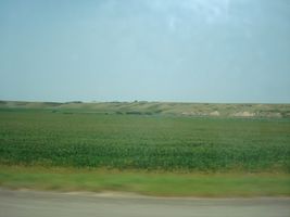
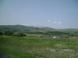
I set out with my parents in their car around 13:00. The terrain began pretty much like this: farms, with the occasional coulee.
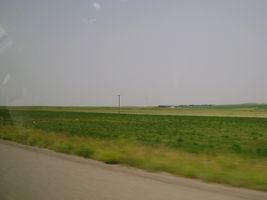
Mostly, though, it was flat.
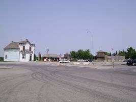
Soon we arrived in Fort Macleod, named after the fort to the right.
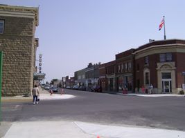
It's a small crap-town outside of Lethbridge, a small crap-city. Fort Mac is only really notable for its fort, its "historic" decrepit buildings, and being a filming site for Brokeback Mountain.
Leaving Fort Mac, there was more prairie!
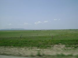
Sometimes the prairie even had cows on it!
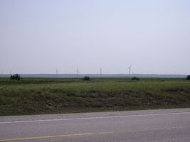
As we started to approach the foothills, we started seeing more windmills. These here provide energy for Calgary.
We then passed through the Blood Reserve, which makes up a large portion of the Pincher Creek graticule.
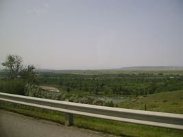
Another coulee.
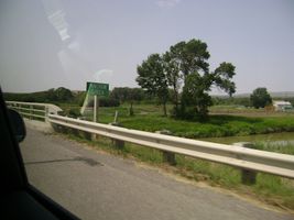
The Pincher Creek!
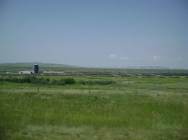
One of the many feedlots we passed. This is where your supermarket beef comes from (if you live in North America). If I showed you any more about these, you'd be making a turn for the vegetarian.
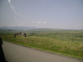
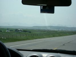
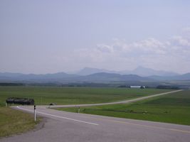
We arrived in Lundbreck around 14:50; the foothills are ahead.
And soon we were in the said foothills.
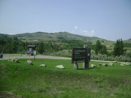
We made a stop at Lundbreck Falls.
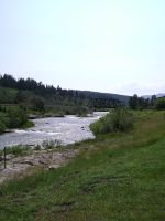
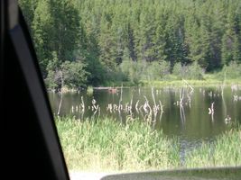
The Crowsnest River, which is the source of the Lundbreck Falls.
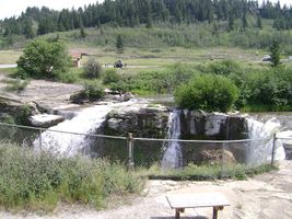
The falls. From here, we took a Range Road down to where the hashpoint was.
By the way, Alberta is windy.
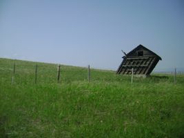
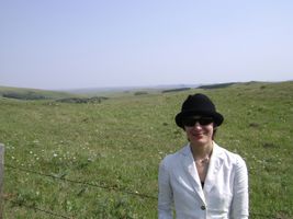
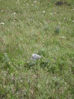
The ranch upon the hashpoint fell was inaccessible. :(
Closest we could get was about 200 metres.
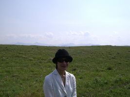
The hashpoint would be where the trees are. Beyond it are Angus cattle (future steaks), and windmills.
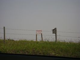
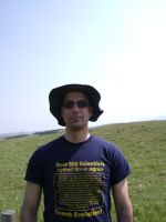
Excitement about getting this far quickly turned into...
...disappointment about not getting to go all the way.
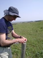
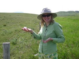
Dad wanted to get to the point too.
We came unprepared for a proxy hash, but would that stop a physicist?
The wind, however, would. The plane didn't fall close enough for a proxyhash to be successful.
My mother proposes another approach to surpassing the wind, which was blowing from the hashpoint. It did not get much further.
And so, we set off to try and find the owners of the ranch. And by the way, Alberta is probably the only region I know of whose coat of arms looks wonderfully representative of its physical geography. Anyway, we talked to the ranch owner's friendly neighbours and found out that this would not be an Ambassadorhash. Alas.
So, we went off to find another picnic location. We found a moose at this one.
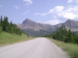
Table Mountain.
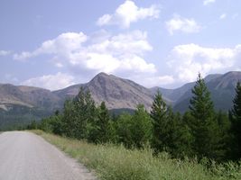
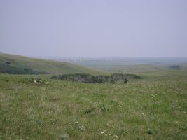
More of the Rockies as we searched for a consolation picnic location.
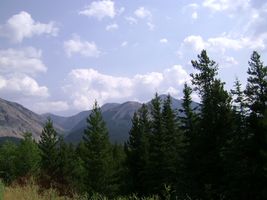
View from where we picniced afterward.


Ribbons
Pending