Difference between revisions of "2009-08-10 33 -84"
imported>NWoodruff m (→NWoodruff) |
imported>NWoodruff m (→Gallery) |
||
| Line 28: | Line 28: | ||
<gallery caption="Photo Gallery" widths="200px" heights="200px" perrow="3"> | <gallery caption="Photo Gallery" widths="200px" heights="200px" perrow="3"> | ||
| − | Image:2009081033-84NW01.JPG| | + | Image:2009081033-84NW01.JPG| 0.25 miles to go from the closest road access. |
| + | Image:2009081033-84NW02.JPG| 1.25 feet to go. Close enough. | ||
| + | Image:2009081033-84NW03.JPG| Time of the meetup. | ||
| + | Image:2009081033-84NW04.JPG| Me with Stupid Grin™ | ||
| + | Image:2009081033-84NW05.JPG| Picture of the actual Geohash Spot. | ||
| + | Image:2009081033-84NW06.JPG| Looking up the mountain. The top of the mountain(or big hill) is to the right of the center of the picture. | ||
| + | Image:2009081033-84NW07.JPG| Looking off into the distance from the Geohash spot. | ||
</gallery> | </gallery> | ||
Revision as of 13:53, 14 August 2009
| Mon 10 Aug 2009 in Atlanta: 33.6641552, -84.1047709 geohashing.info google osm bing/os kml crox |
Graticule
About
Expedition
NWoodruff
This hash point is in the back part of a Georgia State park. It is a mini Stone Mountain as in the climb to the top of this granite rock is only about 300 feet as opposed to Stone Mountain which is 1160 feet.
From the nearest road access point, the hash point is 1/4 of a mile into the woods. I climbed the back part of the mountain and the height difference from the road to the hash point is only 120 feet up. I started to sweat but I didn't get tired out.
It was a great view from where the Geohash point is. I took a few pictures then made the 0.25 mile trek back to my truck. I then headed home for Norcross.
Gallery
- Photo Gallery
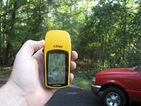
0.25 miles to go from the closest road access.
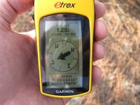
1.25 feet to go. Close enough.
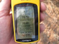
Time of the meetup.

Me with Stupid Grin™
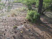
Picture of the actual Geohash Spot.
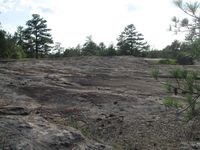
Looking up the mountain. The top of the mountain(or big hill) is to the right of the center of the picture.
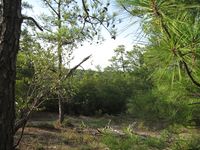
Looking off into the distance from the Geohash spot.


Achievements
NWoodruff earned the Land geohash achievement
|