Difference between revisions of "2009-09-25 -38 146"
imported>MykaDragonBlue (→Photos: <--) |
imported>MykaDragonBlue (→Photos: almost) |
||
| Line 29: | Line 29: | ||
== Photos == | == Photos == | ||
| − | |||
| − | |||
| − | |||
| − | |||
| − | |||
| − | |||
=== Hashing === | === Hashing === | ||
<gallery perrow="4"> | <gallery perrow="4"> | ||
| Line 42: | Line 36: | ||
Image:2009-09-25_-38_146_004.jpg | Not the Hash. | Image:2009-09-25_-38_146_004.jpg | Not the Hash. | ||
Image:2009-09-25_-38_146_005.jpg | Wet and muddy. | Image:2009-09-25_-38_146_005.jpg | Wet and muddy. | ||
| − | |||
</gallery> | </gallery> | ||
=== Licola and the journey Home === | === Licola and the journey Home === | ||
<gallery perrow="4"> | <gallery perrow="4"> | ||
| + | Image:2009-09-25_-38_146_006.jpg | "Beware Falling Rocks". | ||
Image:2009-09-25_-38_146_007.jpg | Sleepy cave. | Image:2009-09-25_-38_146_007.jpg | Sleepy cave. | ||
Image:2009-09-25_-38_146_008.jpg | Sleepy cave from the outside. (in the morning) | Image:2009-09-25_-38_146_008.jpg | Sleepy cave from the outside. (in the morning) | ||
Revision as of 15:19, 26 September 2009
| Fri 25 Sep 2009 in -38,146: -38.1235951, 146.4180346 geohashing.info google osm bing/os kml crox |
Contents
Location
Just off a "road" in Tyers State Park, north of Morwell.
Participants
Plans
I'm driving pretty much past on the way to Liconla, so I'll have a go. Google says there's a road almost to to the hashpoint.
Expedition
Short version
google lied... ok... so technically there's a road, but it was made of mud and slopingness and overgrowingness.
decided to walk the last Km instead and got very wet and muddy and had no GPS reception in the trees and clouds and rain and dark.
Eventually gave up when i got to a 45 Degree slope covered in wet ferns, and it was obvious i would never get a good fix on the hash point.
Managed to walk Directly back to the car though... I wasn't lost (although it could have been managed pretty easily), just couldn't determine where I needed to go.
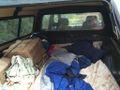
Camped in the Car at Licola over night, then had an annoying drive back to melbourne the next day.
Photos
Hashing
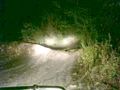
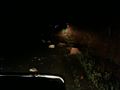
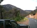
The road became interesting.
That road was stupid.
This road was less stupid, or would have been if it was dry.
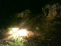
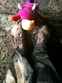
Not the Hash.
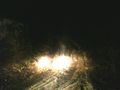
Wet and muddy.


Licola and the journey Home
"Beware Falling Rocks".
Sleepy cave.
Sleepy cave from the outside. (in the morning)
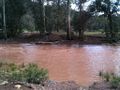
The Wellington River. Not for crossing today.

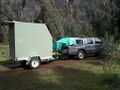
Not a bad spot to park.
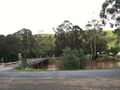
Licola
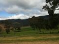
Paddocks and scenery.
Regrowth
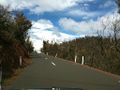
Most of the way down the hill is like this.
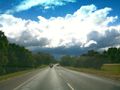
Ominous.
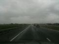
Yup... it was ominous.


