Difference between revisions of "2009-10-02 52 -0"
From Geohashing
imported>Joehardflec (New page: {{subst:Expedition |lat = 52 |lon = -0 |date = 2009-10-02 }}) |
imported>Joehardflec |
||
| Line 1: | Line 1: | ||
| − | |||
<!-- If you did not specify these parameters in the template, please substitute appropriate things for IMAGE, LAT, LON, and DATE (YYYY-MM-DD format) --> | <!-- If you did not specify these parameters in the template, please substitute appropriate things for IMAGE, LAT, LON, and DATE (YYYY-MM-DD format) --> | ||
<!-- | <!-- | ||
| Line 13: | Line 12: | ||
__NOTOC__ | __NOTOC__ | ||
== Location == | == Location == | ||
| − | + | 52,-0 graticule. Just off the footpath between Burton Overy and Kibworth. | |
== Participants == | == Participants == | ||
| − | + | [[User:joehardflec|Joe Hardman]] | |
| − | |||
| − | |||
| − | |||
== Expedition == | == Expedition == | ||
| − | + | Joe set off on a walk geohash at around 11. He headed out from his home in Fleckney, out to the canal at Crane's Lock, crossed the canal, railway, and the A6, and walked to Burton Overy, where he headed back toward Kibworth, stopping off at the hashpoint to take a picture (just a second too late to catch the exact co-ords on screen, but only 0.02arcsecs off) before continuing onward to Kibworth, then heading back to Fleckney, via the electricity substation. | |
== Tracklog == | == Tracklog == | ||
| − | + | See photos | |
== Photos == | == Photos == | ||
| − | |||
| − | |||
| − | |||
| − | |||
| − | |||
<gallery perrow="4"> | <gallery perrow="4"> | ||
| + | Image:2009-10-02 52 -0 GPS.jpg | A very blurry GPS pic. You can just make out the coordinates | ||
| + | Image:2009-10-02 52 -0 Tracklog.jpg | Witty Comment | ||
| + | Image:2009-10-02 52 -0 Joe.jpg | Joe at the hashpoint | ||
| + | Image:2009-10-02 52 -0 View.jpg | The view from the point | ||
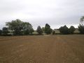
| + | Image:2009-10-02 52 -0 Field.jpg | Looking back on the field | ||
| + | Image:2009-10-02 52 -0 heatsink.jpg | That looks like a hell of a heatsink. | ||
</gallery> | </gallery> | ||
| − | |||
| − | |||
| − | |||
| − | |||
| − | |||
| − | |||
| − | |||
| − | |||
[[Category:Expeditions]] | [[Category:Expeditions]] | ||
| − | |||
[[Category:Expeditions with photos]] | [[Category:Expeditions with photos]] | ||
| − | |||
| − | |||
| − | |||
| − | |||
| − | |||
[[Category:Coordinates reached]] | [[Category:Coordinates reached]] | ||
| − | |||
| − | |||
| − | |||
| − | |||
| − | |||
| − | |||
| − | |||
| − | |||
| − | |||
| − | |||
Revision as of 13:19, 3 October 2009
| Fri 2 Oct 2009 in 52,-0: 52.5598731, -0.9992145 geohashing.info google osm bing/os kml crox |
Location
52,-0 graticule. Just off the footpath between Burton Overy and Kibworth.
Participants
Expedition
Joe set off on a walk geohash at around 11. He headed out from his home in Fleckney, out to the canal at Crane's Lock, crossed the canal, railway, and the A6, and walked to Burton Overy, where he headed back toward Kibworth, stopping off at the hashpoint to take a picture (just a second too late to catch the exact co-ords on screen, but only 0.02arcsecs off) before continuing onward to Kibworth, then heading back to Fleckney, via the electricity substation.
Tracklog
See photos
Photos
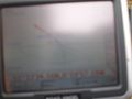
A very blurry GPS pic. You can just make out the coordinates
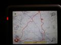
Witty Comment
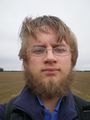
Joe at the hashpoint
The view from the point
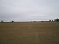
Looking back on the field
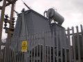
That looks like a hell of a heatsink.


