Difference between revisions of "2009-10-27 50 9"
imported>Danatar |
imported>Danatar (+pictures) |
||
| Line 22: | Line 22: | ||
<gallery> | <gallery> | ||
| − | Image: | + | Image:2009-10-27_50_9_zinkenmuehle.jpg|Zinkenmühle |
| + | Image:2009-10-27_50_9_gps.jpg|GPS | ||
| + | Image:2009-10-27_50_9_grass.jpg| | ||
</gallery> | </gallery> | ||
Revision as of 21:00, 3 November 2009
| Tue 27 Oct 2009 in Fulda: 50.0266602, 9.9988727 geohashing.info google osm bing/os kml crox |
Location
Today's location is on the slope between a meadow and a creek near the Zinkenmühle, at Schwebenried, a part of Arnstein.
Country: Germany; state: Bayern (Bavaria, EU:DE:BY); administrative region: Unterfranken; district: Main-Spessart
Expedition
Danatar
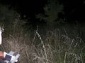
While driving home from work I drove off the Autobahn and continued on the country highway through the night to Schwebenried. When leaving Schwebenried, a tabby cat crossed the road in front of me. I hit the brakes hard, the cat stopped for a moment, then it continued and vanished in the grass. A few hundred metres later I parked the car on the track leading to the Zinkenmühle (Mühle means mill). On foot I followed the track between the houses and onwards to fields, then along the side of a meadow. Soon I was a few metres from the hashpoint, which lay on a slope near a creek, in high grass. Carefully I descended the last 3 metres ("if I get hurt it will be a long time until I'm found") to the spot, took some pictures and climbed back up. I walked to the car and drove home.
Detour total: 14.8 km, 37 minutes.
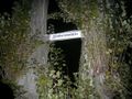
Zinkenmühle

GPS