Difference between revisions of "2010-03-09 42 12"
From Geohashing
imported>Relet |
imported>Relet (summary) |
||
| Line 13: | Line 13: | ||
* [[User:relet|relet]] | * [[User:relet|relet]] | ||
| − | == Plans == | + | == No Plans == |
| − | |||
| − | == Expedition == | + | == Expedition summary == |
| + | <gallery> | ||
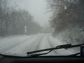
| + | File:2010-03-09_42_13_P1050747.JPG | Strada privada. | ||
| + | </gallery> | ||
| − | |||
| − | |||
| − | |||
| − | |||
| − | |||
| − | |||
[[Category:Expeditions]] | [[Category:Expeditions]] | ||
| − | |||
[[Category:Expeditions with photos]] | [[Category:Expeditions with photos]] | ||
| − | |||
| − | |||
| − | |||
| − | |||
| − | |||
| − | |||
| − | |||
| − | |||
| − | |||
| − | |||
| − | |||
| − | |||
[[Category:Not reached - No public access]] | [[Category:Not reached - No public access]] | ||
| − | |||
| − | |||
| − | |||
Revision as of 15:03, 10 March 2010
| Tue 9 Mar 2010 in 42,12: 42.3006762, 12.4916585 geohashing.info google osm bing/os kml crox |
Location
A sheep farm / meadow / grass near the highway, on a peninsula connected by only one track.
Participants
No Plans
Expedition summary
Strada privada.
