Difference between revisions of "2010-05-09 32 -111"
From Geohashing
imported>Wyle & RoadRunner (Created page with '{{meetup graticule | lat=32 | lon=-111 | date=2010-05-09 | graticule_name=Casa Grande | graticule_link=Casa Grande, Arizona}} == Location == Sahuaro National Park - West == Pa…') |
imported>Wyle & RoadRunner m |
||
| Line 20: | Line 20: | ||
Image:2010-05-09_32_-111_gps.jpg|Casa Grande, Arizona | Image:2010-05-09_32_-111_gps.jpg|Casa Grande, Arizona | ||
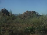
Image:2010-05-09_32_-111_view.jpg|Casa Grande, Arizona | Image:2010-05-09_32_-111_view.jpg|Casa Grande, Arizona | ||
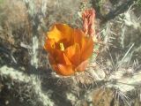
| + | Image:2010-05-09_32_-111_cholla.jpg|Casa Grande, Arizona | ||
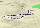
Image:2010-05-09_32_-111_track.jpg|Casa Grande, Arizona | Image:2010-05-09_32_-111_track.jpg|Casa Grande, Arizona | ||
</gallery> | </gallery> | ||
Revision as of 04:50, 10 May 2010
| Sun 9 May 2010 in Casa Grande: 32.3330888, -111.1312620 geohashing.info google osm bing/os kml crox |
Location
Sahuaro National Park - West
Participants
- Wyle
- Roadrunner
Expeditions
Oh, man. Its been 3+ month since a geohash, but what a wonderful one today. Almost in RoadRunners back yard and right on the boundary (literally at the fence) of Sauharo National Park (West). A small jaunt up and over the ridge and then down through the dry wash into the flatland. A slightly different trek out and it was back to the car. No cactus encounters (except for RoadRunner's sunglasses and Wyle's hat), but lots of cholla in bloom.


