Difference between revisions of "2010-05-31 47 6"
From Geohashing
imported>Crox m (new report coming soon) |
imported>Crox (report !) |
||
| Line 1: | Line 1: | ||
| − | |||
| − | |||
| − | |||
| − | |||
| − | |||
| − | |||
| − | |||
{{meetup graticule | {{meetup graticule | ||
| lat=47 | | lat=47 | ||
| Line 15: | Line 8: | ||
__NOTOC__ | __NOTOC__ | ||
== Location == | == Location == | ||
| − | + | [[wikipedia:Les Pontins|Les Pontins]], [[wikipedia:Saint-Imier|St-Imier]], BE, Switzerland | |
== Participants == | == Participants == | ||
| − | + | * [[User:Crox|Crox]] | |
== Plans == | == Plans == | ||
| − | + | This looked like a good opportunity for an after-work virgin graticule achievement. | |
== Expedition == | == Expedition == | ||
| − | + | The expedition itself was similar to [[2010-05-25_46_6]], minus the nice weather, and driving from Neuchâtel instead of Romont. Map 5024 and Mobility got me within 250m of the hash, the GPS and my feet then did the rest. | |
| − | |||
| − | |||
| − | |||
== Photos == | == Photos == | ||
| Line 34: | Line 24: | ||
--> | --> | ||
<gallery perrow="5"> | <gallery perrow="5"> | ||
| + | Image:2010-05-31_47_6-01-hash-img_0397.jpg | it's there | ||
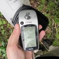
| + | Image:2010-05-31_47_6-02-reached-img_0398.jpg | coordinates reached ! | ||
| + | Image:2010-05-31_47_6-03-marker-img_0400.jpg | marker left | ||
| + | Image:2010-05-31_47_6-04-crox-img_0404.jpg | [[User:Crox|Crox]] at the hash | ||
| + | Image:2010-05-31_47_6-05-view_from_hash-img_0407-img_0408.jpg | view from the hash | ||
</gallery> | </gallery> | ||
| Line 39: | Line 34: | ||
{{#vardefine:ribbonwidth|800px}} | {{#vardefine:ribbonwidth|800px}} | ||
<!-- Add any achievement ribbons you earned below, or remove this section --> | <!-- Add any achievement ribbons you earned below, or remove this section --> | ||
| + | {{Virgin graticule | ||
| + | | latitude = 47 | ||
| + | | longitude = 6 | ||
| + | | date = 2010-05-31 | ||
| + | | name = [[User:Crox|Crox]] | ||
| + | }} | ||
| − | |||
| − | |||
| − | |||
| − | |||
| − | |||
| − | |||
| − | |||
| − | |||
| − | |||
| − | |||
[[Category:Expeditions]] | [[Category:Expeditions]] | ||
| − | |||
[[Category:Expeditions with photos]] | [[Category:Expeditions with photos]] | ||
| − | |||
| − | |||
| − | |||
| − | |||
| − | |||
[[Category:Coordinates reached]] | [[Category:Coordinates reached]] | ||
| − | |||
| − | |||
| − | |||
| − | |||
| − | |||
| − | |||
| − | |||
| − | |||
| − | |||
| − | |||
Revision as of 22:19, 31 May 2010
| Mon 31 May 2010 in 47,6: 47.1293064, 6.9973130 geohashing.info google osm bing/os kml crox |
Location
Les Pontins, St-Imier, BE, Switzerland
Participants
Plans
This looked like a good opportunity for an after-work virgin graticule achievement.
Expedition
The expedition itself was similar to 2010-05-25_46_6, minus the nice weather, and driving from Neuchâtel instead of Romont. Map 5024 and Mobility got me within 250m of the hash, the GPS and my feet then did the rest.
Photos
Crox at the hash


