Difference between revisions of "2010-06-12 40 -90"
imported>Dvdllr |
imported>Dvdllr |
||
| Line 14: | Line 14: | ||
== Expedition == | == Expedition == | ||
| − | I will fill this out | + | I will fill this out tomorrow, I PROMISE |
== Photos == | == Photos == | ||
<gallery perrow="5"> | <gallery perrow="5"> | ||
| − | Image: | + | Image:2010-06-12 40 -90 1.jpg | Just getting started. I didn't fill in the date on the flag in case I didn't make it. |
| + | Image:2010-06-12 40 -90 2.jpg | From the road, the hashpoint is in this general direction. | ||
| + | Image:2010-06-12 40 -90 3.jpg | A terribly blurry picture, but it's the only one I took while traipsing towards the point. | ||
| + | Image:2010-06-12 40 -90 4.jpg | Geohashing | ||
| + | Image:2010-06-12 40 -90 5.jpg | This is it! | ||
| + | Image:2010-06-12 40 -90 6.jpg | I claim this land for geohashing | ||
| + | Image:2010-06-12 40 -90 7.jpg | My car, viewed from the hashpoint (zoomed in) | ||
| + | Image:2010-06-12 40 -90 8.jpg | Spoon River bridge | ||
| + | Image:2010-06-12 40 -90 9.jpg | Mr. Soggy Shorts | ||
| + | Image:2010-06-12 40 -90 10.jpg | Well that was an adventure | ||
| + | Image:2010-06-12 40 -90 11.jpg | I didn't stop in to see if Miracle Max was there | ||
| + | Image:2010-06-12 40 -90 12.jpg | You know you're in a small town when... | ||
| + | Image:2010-06-12 40 -90 13.jpg | Re-approching the hashpoint, you see where the field meets the jungle | ||
| + | Image:2010-06-12 40 -90 14.jpg | An orange flag lies somewhere in the wilderness | ||
| + | Image:2010-06-12 40 -90 15.jpg | I don't have time for this! | ||
| + | Image:2010-06-12 40 -90 16.jpg | Moo | ||
| + | Image:2010-06-12 40 -90 17.jpg | Half a drowned rat | ||
</gallery> | </gallery> | ||
== Achievements == | == Achievements == | ||
{{#vardefine:ribbonwidth|800px}} | {{#vardefine:ribbonwidth|800px}} | ||
| + | {{land geohash | ||
| + | |||
| + | | latitude = 40 | ||
| + | | longitude = -90 | ||
| + | | date = 2010-06-12 | ||
| + | | name = [[User:Dvdllr|Dvdllr]] | ||
| + | }} | ||
| + | {{Drowned rat geohash | ||
| + | |||
| + | | latitude = 40 | ||
| + | | longitude = -90 | ||
| + | | date = 2010-06-12 | ||
| + | | name = [[User:Dvdllr|Dvdllr]] | ||
| + | | image = 2010-06-12 40 -90 5.jpg | ||
| + | | reason = bushwhacking through wet vegetation in the rain (but keeping head and shoulders under an umbrella) | ||
| + | | honourable = yes | ||
| + | }} | ||
{{Virgin graticule | {{Virgin graticule | ||
Revision as of 03:17, 13 June 2010
| Sat 12 Jun 2010 in 40,-90: 40.8070820, -90.1346896 geohashing.info google osm bing/os kml crox |
Location
Next to Spoon River, near the village of Maquon, Illinois
Participants
Plans
Expedition
I will fill this out tomorrow, I PROMISE
Photos

Just getting started. I didn't fill in the date on the flag in case I didn't make it.

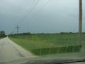
From the road, the hashpoint is in this general direction.

A terribly blurry picture, but it's the only one I took while traipsing towards the point.

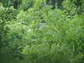
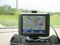
Geohashing

This is it!

I claim this land for geohashing
My car, viewed from the hashpoint (zoomed in)

Spoon River bridge
Mr. Soggy Shorts

Well that was an adventure

I didn't stop in to see if Miracle Max was there
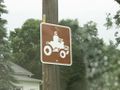
You know you're in a small town when...
Re-approching the hashpoint, you see where the field meets the jungle

An orange flag lies somewhere in the wilderness
I don't have time for this!

Moo

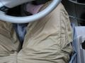
Half a drowned rat


Achievements
Dvdllr earned the Land geohash achievement
|
Dvdllr earned the Drowned Rat Geohash Honourable Mention
|