Difference between revisions of "2010-09-13 48 9"
imported>Ekorren (minimum report and gallery) |
imported>FippeBot m (Location) |
||
| Line 35: | Line 35: | ||
[[Category:Coordinates reached]] | [[Category:Coordinates reached]] | ||
[[Category:Expeditions with photos]] | [[Category:Expeditions with photos]] | ||
| + | {{location|DE|BW|TÜ}} | ||
Revision as of 03:42, 9 August 2019
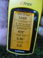
| Mon 13 Sep 2010 in 48,9: 48.4423061, 9.0250776 geohashing.info google osm bing/os kml crox |
Contents
Location
In the Rammert forest near Dußlingen.
Participants
- Ekorren
Expedition
Although it didn't really fit to my plans for the day, I went there. It was simply too close to skip, and also that hash was on the area of a municipality in my home district which I hadn't hashed in before. One more for the regions list, that is.
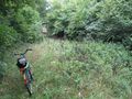
I went there by bike, which was pretty much straightforward except of the last part where the track shown on the map turned out to be not much more than an overgrown logging aisle. However, it _was_ possible to proceed with the bike, even faster than walking.
After visiting the hash, I raced down to Rottenburg but found it was too late for another detour I had considered. So I raced further on, to Bondorf, where I took a train to Stuttgart for my evening plans.
Photos
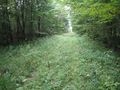
This is a way?
Well, it's good enough.
In there
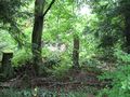
The hashpoint
Coordinates reached
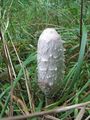
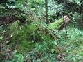
There's not only trees here!
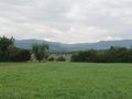
View from the forest margin
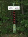
Ancient district border


