Difference between revisions of "2010-12-12 47 8"
From Geohashing
imported>TheOneRing (→Photos) |
imported>TheOneRing (→Photos) |
||
| Line 19: | Line 19: | ||
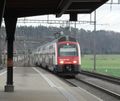
Image:20101212Train1.jpg|The train to Bassersdorf | Image:20101212Train1.jpg|The train to Bassersdorf | ||
Image:20101212TrainStation.jpg|The train station of Bassersdorf | Image:20101212TrainStation.jpg|The train station of Bassersdorf | ||
| − | Image:MeplusFlag.jpg| | + | Image:MeplusFlag.jpg|Non-stupid grin (Swiss flag in the background) |
Image:20101212hashpoint.jpg|The tripod marks the geohash (or maybe it is the Apple tree) | Image:20101212hashpoint.jpg|The tripod marks the geohash (or maybe it is the Apple tree) | ||
Image:20101212GPS.jpg|The proof that I reached the right coordinates... | Image:20101212GPS.jpg|The proof that I reached the right coordinates... | ||
Revision as of 16:47, 12 December 2010
| Sun 12 Dec 2010 in 47,8: 47.4447425, 8.6258899 geohashing.info google osm bing/os kml crox |
The Place
The geohash is in Bassersdorf near Zürich.
Who Went
TheOneRing - by public transport.
The Expedition
The OneRing
I decided to go by train to Zürich, Switzerland and from there with another train to Bassersdorf. The village itself is near the airport "Zürich-Kloten" which I recognized immediately, because every minute a plane was starting and flew over me. After arriving at the train station in Bassersdorf the geohash was approx. 2km in side te village. On the way I saw a cat but it ran away from me so I could not pet it. Finally the geohash was located on a hill, not on top but on a hillside. It was marked with a great flag of Switzerland, which stand 5m next to the geohash. The countryside was not very attractive and after taking the usual photos I left the place.
Photos
Achievements
TheOneRing earned the Land geohash achievement
|
TheOneRing earned the Public transport geohash achievement
|
TheOneRing achieved level 1 of the Minesweeper Geohash achievement
|


