Difference between revisions of "2011-01-09 46 6"
From Geohashing
imported>NeThuS (Created page with "{{subst:Expedition |lat = latitude of graticule |lon = longitude of graticule |date = date of expedition, in YYYY-MM-DD format }}") |
imported>NeThuS |
||
| Line 1: | Line 1: | ||
| − | |||
| − | |||
| − | |||
| − | |||
| − | |||
| − | |||
| − | |||
| − | |||
| − | |||
| − | |||
{{meetup graticule | {{meetup graticule | ||
| − | | lat= | + | | lat=46 |
| − | | lon= | + | | lon=6 |
| − | | date= | + | | date=2011-01-09 |
}} | }} | ||
| − | |||
| − | |||
__NOTOC__ | __NOTOC__ | ||
== Location == | == Location == | ||
| − | + | Montcherand, Switzerland. just outside of the town-center, 1 meter off the road | |
== Participants == | == Participants == | ||
| − | + | [[User: NeThuS|NeThuS]] | |
== Plans == | == Plans == | ||
| − | + | A quick detour on my trip from Genève to Basel | |
== Expedition == | == Expedition == | ||
| − | + | pulled over during a rainy evening, switched from car-GPS to handheld GPS to locate the exact spot, took a picture and left again. | |
== Tracklog == | == Tracklog == | ||
| − | + | available on request | |
== Photos == | == Photos == | ||
| − | |||
| − | |||
| − | |||
<gallery perrow="5"> | <gallery perrow="5"> | ||
| + | Image:2011_01_09_46_6--1.jpg | The hash | ||
| + | Image:2011 01 09 46 6--2.jpg | a mysterious hole right next to the hash. I didn't looked into it, otherwise it wouldn't be a mystery, right? | ||
</gallery> | </gallery> | ||
== Achievements == | == Achievements == | ||
{{#vardefine:ribbonwidth|800px}} | {{#vardefine:ribbonwidth|800px}} | ||
| − | + | I could claim the drowned rat ribbon, but getting out of my car for a minute wasn't that bad. | |
| − | |||
| − | |||
[[Category:New report]] | [[Category:New report]] | ||
| − | |||
| − | |||
| − | |||
| − | |||
| − | |||
| − | |||
| − | |||
[[Category:Expeditions]] | [[Category:Expeditions]] | ||
| − | |||
[[Category:Expeditions with photos]] | [[Category:Expeditions with photos]] | ||
| − | |||
| − | |||
| − | |||
| − | |||
| − | |||
[[Category:Coordinates reached]] | [[Category:Coordinates reached]] | ||
| − | |||
| − | |||
| − | |||
| − | |||
| − | |||
| − | |||
| − | |||
| − | |||
| − | |||
| − | |||
Revision as of 21:37, 9 January 2011
| Sun 9 Jan 2011 in 46,6: 46.7329038, 6.5043826 geohashing.info google osm bing/os kml crox |
Location
Montcherand, Switzerland. just outside of the town-center, 1 meter off the road
Participants
Plans
A quick detour on my trip from Genève to Basel
Expedition
pulled over during a rainy evening, switched from car-GPS to handheld GPS to locate the exact spot, took a picture and left again.
Tracklog
available on request
Photos
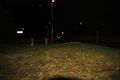
The hash
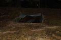
a mysterious hole right next to the hash. I didn't looked into it, otherwise it wouldn't be a mystery, right?


Achievements
I could claim the drowned rat ribbon, but getting out of my car for a minute wasn't that bad.