Difference between revisions of "2011-03-24 49 8"
imported>Ilpadre (tracklog) |
imported>Ilpadre (→Photos) |
||
| Line 27: | Line 27: | ||
<gallery> | <gallery> | ||
| + | File:2011-03-24 49 8 neckarwiese.jpg|Every time the sun comes out, it soon gets crowded here. | ||
| + | File:2011-03-24 49 8 neckar.jpg|Still a beautiful sight, even after six years of living in Heidelberg. | ||
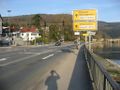
| + | File:2011-03-24 49 8 baustelle.jpg|The traffic on that road is restricted by extensive construction work. | ||
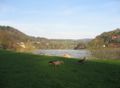
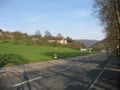
| + | File:2011-03-24 49 8 geese.jpg | ||
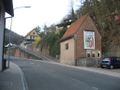
| + | File:2011-03-24 49 8 stift.jpg|A Benedictine monastery. | ||
| + | File:2011-03-24 49 8 lefthere.jpg|Leaving the Nackar to turn left here. | ||
| + | File:2011-03-24 49 8 peterstal.jpg|"Peterstal greets you all." | ||
| + | File:2011-03-24 49 8 approaching.jpg|Getting closer. The point is somewhere to the left. | ||
| + | File:2011-03-24 49 8 stupidgrin.jpg|Obligatory. | ||
| + | File:2011-03-24 49 8 west.jpg|At the hashpoint, looking west. | ||
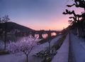
| + | File:2011-03-24 49 8 sunset.jpg|Back at the Neckar. | ||
| + | File:2011-03-24 49 8 bat.jpg|They were much to fast for me. | ||
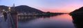
| + | File:2011-03-24 49 8 panorama1.jpg|Heidelberg's treasured Old Bridge, built in the 1780s, destroyed by the Wehrmacht in 1945, then rebuilt. | ||
| + | File:2011-03-24 49 8 panorama2.jpg|Standing on that bridge. | ||
| + | File:2011-03-24 49 8 skatepark.jpg|Building a skatepark. | ||
| + | File:2011-03-24 49 8 2h59min59s.jpg|Back home after 3 hours. | ||
</gallery> | </gallery> | ||
Revision as of 07:36, 25 March 2011
| Thu 24 Mar 2011 in 49,8: 49.4534780, 8.7590657 geohashing.info google osm bing/os kml crox |
Location
Between Peterstal (since 1975 a part of Heidelberg, the point itself is close to Heidelberg's northernmost point) and Wilhelmsfeld, near a street, in very steep terrain.
Plans
-
Participants
Expedition
-
Tracklog
http://www.everytrail.com/view_trip.php?trip_id=1011770 (bad reception during large parts of the trip)
Photos
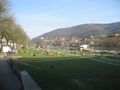
Every time the sun comes out, it soon gets crowded here.
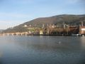
Still a beautiful sight, even after six years of living in Heidelberg.
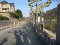
The traffic on that road is restricted by extensive construction work.
A Benedictine monastery.
Leaving the Nackar to turn left here.
"Peterstal greets you all."
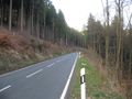
Getting closer. The point is somewhere to the left.
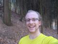
Obligatory.
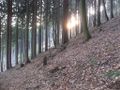
At the hashpoint, looking west.
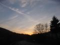
Back at the Neckar.
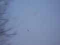
They were much to fast for me.
Heidelberg's treasured Old Bridge, built in the 1780s, destroyed by the Wehrmacht in 1945, then rebuilt.
Standing on that bridge.
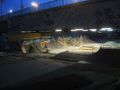
Building a skatepark.
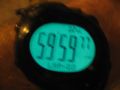
Back home after 3 hours.


