Difference between revisions of "2011-04-01 34 -83"
From Geohashing
imported>Tomkf61 |
imported>Tomkf61 |
||
| Line 81: | Line 81: | ||
<!-- Add any achievement ribbons you earned below, or remove this section --> | <!-- Add any achievement ribbons you earned below, or remove this section --> | ||
| + | {{land geohash | latitude = 34 | longitude = -83 | date = 2011-04-01 | name = tomkf61}} | ||
| + | {{Geotrash | latitude = 34 | longitude = -83 | date = 2011-04-01 | name = tomkf61}} | ||
<!-- =============== USEFUL CATEGORIES FOLLOW ================ | <!-- =============== USEFUL CATEGORIES FOLLOW ================ | ||
Revision as of 03:52, 2 April 2011
| Fri 1 Apr 2011 in 34,-83: 34.5523773, -83.3726063 geohashing.info google osm bing/os kml crox |
Location
On north side of Highway 17 (Toccoa Bypass), 4.75 kilometers from Toccoa, GA.
Participants
Plans
Will update soon.
Expedition
Will update soon.
Photos
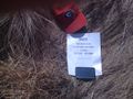
Hash 2011-04-01 34 -83.
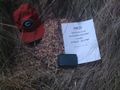
Hash 2011-04-01 34 -83.
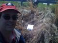
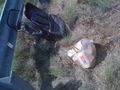
Stupid Grin.
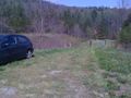
Where I parked.
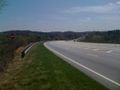
View down Hwy 17.
View of Currahee Mountain. (South)
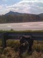
GeoTrash cleanup.
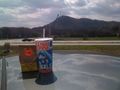
GeoSquishy (Currahee Mtn in distance).

Stephens Co., GA Courthouse.
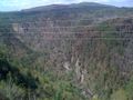
View of Tallulah Gorge.


Achievements
tomkf61 earned the Land geohash achievement
|
tomkf61 earned the GeoTrash Geohash Achievement
|