Difference between revisions of "2011-06-03 66 25"
From Geohashing
imported>Isopekka |
imported>Isopekka |
||
| Line 36: | Line 36: | ||
Image:Gh-2010-06-03-scrn.jpg| The Proof. | Image:Gh-2010-06-03-scrn.jpg| The Proof. | ||
Image:Gd+gh 2011-05-03 013.JPG| Another Proof. | Image:Gd+gh 2011-05-03 013.JPG| Another Proof. | ||
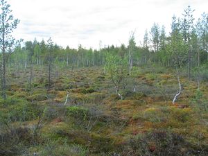
| − | Image:Gd+gh 2011-05-03 014.JPG| View | + | Image:Gd+gh 2011-05-03 014.JPG| View from the Hashpoint. |
Image:Gd+gh 2011-05-03 015.JPG| Hasher at the Hashpoint with broken left arm. | Image:Gd+gh 2011-05-03 015.JPG| Hasher at the Hashpoint with broken left arm. | ||
Image:Gd+gh 2011-05-03 017.JPG| Red marks on the way back. Maybe for snowscooter trail... | Image:Gd+gh 2011-05-03 017.JPG| Red marks on the way back. Maybe for snowscooter trail... | ||
| − | Image:Gd+gh 2011-05-03 018.JPG| Old dead school in Välijoki | + | Image:Gd+gh 2011-05-03 018.JPG| Old dead (or killed) school in the village of Välijoki, about 1 km from the Hash. |
Image:Gd+gh 2011-05-03 019.JPG| The schoolyard of the dead school. | Image:Gd+gh 2011-05-03 019.JPG| The schoolyard of the dead school. | ||
Revision as of 15:45, 4 June 2011
| Fri 3 Jun 2011 in 66,25: 66.2445310, 25.8069657 geohashing.info google osm bing/os kml crox |
Contents
Location
50 km to the S from the city Rovaniemi, in the forest, in the village of Välijoki.
Participants
Expedition
- By car total 100 km
- Walking total 1.0 km
- Expedition took 2 h
- Physical effort (1-5): 3
Photos
Achievements
isopekka earned the Land geohash achievement
|
Geohashing Expeditions and Plans on This Day
Expeditions and Plans
| 2011-06-03 | ||
|---|---|---|
| Townsville, Australia | mattyk | In the city, not in any restricted military zones, and actually accessible!... |
| Rovaniemi, Finland | isopekka | 50 km to the S from the city Rovaniemi, in the forest, in the village of Vä... |


