Difference between revisions of "2011-08-14 50 10"
imported>Reinhard (report) |
imported>Reinhard (you know Rottenbach ...) |
||
| Line 14: | Line 14: | ||
== Expedition == | == Expedition == | ||
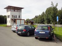
| − | Reinhard was going to look for bike paths and small roads in the area around Coburg and liked the hashpoint to be within this area. His mission was to find and GPS-record every single paved path between Rottenbach and Wiesenfeld bei Coburg where the hashpoint was. Since he didn't want to lose too much time on the way from Schleusingen to Rottenbach, he drove the 24 km by car to the A73 exit Eisfeld-Süd and began his bike ride at a parking area exactly at the former border between East and West Germany which nowadays is even hard to recognize as the border between Thuringia and Bavaria. | + | Reinhard was going to look for bike paths and small roads in the area around Coburg and liked the hashpoint to be within this area. His mission was to find and GPS-record every single paved path between Rottenbach (well-known for [[2009-04-12_50_10|an other geohash]]) and Wiesenfeld bei Coburg where the hashpoint was. Since he didn't want to lose too much time on the way from Schleusingen to Rottenbach, he drove the 24 km by car to the A73 exit Eisfeld-Süd and began his bike ride at a parking area exactly at the former border between East and West Germany which nowadays is even hard to recognize as the border between Thuringia and Bavaria. |
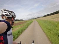
Without being bothered by any border guard, he quickly proceeded into the West (or South) and started his tracking mission. First, he thought, taking the most right path at a junction and then coming back to it taking the path to the left of the former path (and so on) would be a good plan not to miss any path, but when he arrived in the 3rd or 4th sub-level of junctions and still found unknown ways, he gave up on recording 100 percent of the area's bike path network and decided a good percentage would have to suffice. | Without being bothered by any border guard, he quickly proceeded into the West (or South) and started his tracking mission. First, he thought, taking the most right path at a junction and then coming back to it taking the path to the left of the former path (and so on) would be a good plan not to miss any path, but when he arrived in the 3rd or 4th sub-level of junctions and still found unknown ways, he gave up on recording 100 percent of the area's bike path network and decided a good percentage would have to suffice. | ||
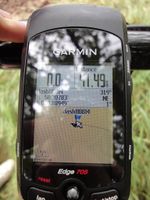
This way, instead of cycling 13 km to the hashpoint, Reinhard cycled ?? km before he got there. The hashpoint was easily reached by walking 50 m along the edge of the field (on which no plants were growing). The way back to the car was less meander-like, but still not the shortest, so Reinhard reached his car after 61 km and got back to Manu's family on time for lunch. | This way, instead of cycling 13 km to the hashpoint, Reinhard cycled ?? km before he got there. The hashpoint was easily reached by walking 50 m along the edge of the field (on which no plants were growing). The way back to the car was less meander-like, but still not the shortest, so Reinhard reached his car after 61 km and got back to Manu's family on time for lunch. | ||
| − | |||
== Photos == | == Photos == | ||
Revision as of 15:14, 15 August 2011
| Sun 14 Aug 2011 in 50,10: 50.3078350, 10.8894935 geohashing.info google osm bing/os kml crox |
Location
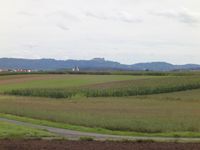
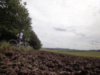
Between a field and wood land near Wiesenfeld bei Coburg (Bavaria).
Participants
Expedition
Reinhard was going to look for bike paths and small roads in the area around Coburg and liked the hashpoint to be within this area. His mission was to find and GPS-record every single paved path between Rottenbach (well-known for an other geohash) and Wiesenfeld bei Coburg where the hashpoint was. Since he didn't want to lose too much time on the way from Schleusingen to Rottenbach, he drove the 24 km by car to the A73 exit Eisfeld-Süd and began his bike ride at a parking area exactly at the former border between East and West Germany which nowadays is even hard to recognize as the border between Thuringia and Bavaria.
Without being bothered by any border guard, he quickly proceeded into the West (or South) and started his tracking mission. First, he thought, taking the most right path at a junction and then coming back to it taking the path to the left of the former path (and so on) would be a good plan not to miss any path, but when he arrived in the 3rd or 4th sub-level of junctions and still found unknown ways, he gave up on recording 100 percent of the area's bike path network and decided a good percentage would have to suffice.
This way, instead of cycling 13 km to the hashpoint, Reinhard cycled ?? km before he got there. The hashpoint was easily reached by walking 50 m along the edge of the field (on which no plants were growing). The way back to the car was less meander-like, but still not the shortest, so Reinhard reached his car after 61 km and got back to Manu's family on time for lunch.
Photos
|
