Difference between revisions of "2011-09-22 45 -121"
From Geohashing
imported>Michael5000 m (→Achievements) |
imported>Kydlt |
||
| Line 2: | Line 2: | ||
| lat=45 | | lat=45 | ||
| lon=-121 | | lon=-121 | ||
| − | | date=2011- | + | | date=2011-10-01 |
}} | }} | ||
| − | [[Image:2011- | + | [[Image:2011-10-01 45 -121 cell camera.jpg|thumb|left|300 px|Photo of a photo.]] |
__NOTOC__ | __NOTOC__ | ||
== Location == | == Location == | ||
| − | + | Odell, OR. | |
== Participants == | == Participants == | ||
* [[User:Kydlt|Kydlt]] | * [[User:Kydlt|Kydlt]] | ||
| − | |||
| − | |||
== Plans == | == Plans == | ||
| − | + | Not much of a plan, I just ended up here. | |
== Expedition == | == Expedition == | ||
| Line 25: | Line 23: | ||
===Kydlt=== | ===Kydlt=== | ||
| − | + | I was thinking of going into Vancouver this AM for the 45,-121 hash and maybe a meetup before the grandchildren came out, but life intervened. Freecycle had some RR ties for me in Dee, OR, too good a deal to pass up. But LO, the The Dalles hash was in Odell and that was on the way. So I loaded the hash into the GPS & took off. No camera today. They were busy in the orchard and didn't want me wandering, so I only got to within about 500 ft. But I tried. | |
| − | |||
| − | |||
| − | |||
| − | |||
| − | |||
| − | |||
== Tracklog == | == Tracklog == | ||
| − | |||
| − | |||
| + | [[Image:2011-10-01 45 -121 screen capture.jpg|thumb|left|300 px|Photo of a LCD.]] When I got home I put the trail on the laptop, and here's a screen capture. | ||
== Photos == | == Photos == | ||
<gallery perrow="5"> | <gallery perrow="5"> | ||
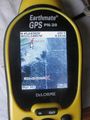
| − | Image:2011- | + | Image:2011-10-01 45 -121 gps.jpg |Kind of a lame effort, but an effort all the same. |
| − | |||
| − | |||
| − | |||
| − | |||
| − | |||
</gallery> | </gallery> | ||
== Achievements == | == Achievements == | ||
| − | |||
| − | |||
| − | |||
| − | |||
[[Category:Expeditions]] | [[Category:Expeditions]] | ||
[[Category:Expeditions with photos]] | [[Category:Expeditions with photos]] | ||
[[Category:Coordinates reached]] | [[Category:Coordinates reached]] | ||
Revision as of 00:34, 2 October 2011
| Sat 1 Oct 2011 in 45,-121: 45.6414014, -121.5396268 geohashing.info google osm bing/os kml crox |

Location
Odell, OR.
Participants
Plans
Not much of a plan, I just ended up here.
Expedition
Kydlt
I was thinking of going into Vancouver this AM for the 45,-121 hash and maybe a meetup before the grandchildren came out, but life intervened. Freecycle had some RR ties for me in Dee, OR, too good a deal to pass up. But LO, the The Dalles hash was in Odell and that was on the way. So I loaded the hash into the GPS & took off. No camera today. They were busy in the orchard and didn't want me wandering, so I only got to within about 500 ft. But I tried.
Tracklog
File:2011-10-01 45 -121 screen capture.jpg
Photo of a LCD.
When I got home I put the trail on the laptop, and here's a screen capture.
Photos
Kind of a lame effort, but an effort all the same.
