Difference between revisions of "2011-11-12 41 -88"
From Geohashing
imported>EvilUncleNomo ([live picture] Deer tracks! [http://www.openstreetmap.org/?lat=41.74826768333333&lon=-88.49358491666666&zoom=16&layers=B000FTF @41.7483,-88.4936]) |
imported>EvilUncleNomo ([live picture] Child of the corn. [http://www.openstreetmap.org/?lat=41.748101733333336&lon=-88.4934656&zoom=16&layers=B000FTF @41.7481,-88.4935]) |
||
| Line 42: | Line 42: | ||
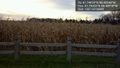
Image:2011-11-12_41_-88_16-06-59-447.jpg | Deer tracks! [http://www.openstreetmap.org/?lat=41.74826768333333&lon=-88.49358491666666&zoom=16&layers=B000FTF @41.7483,-88.4936] | Image:2011-11-12_41_-88_16-06-59-447.jpg | Deer tracks! [http://www.openstreetmap.org/?lat=41.74826768333333&lon=-88.49358491666666&zoom=16&layers=B000FTF @41.7483,-88.4936] | ||
| + | |||
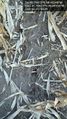
| + | Image:2011-11-12_41_-88_16-13-53-092.jpg | Child of the corn. [http://www.openstreetmap.org/?lat=41.748101733333336&lon=-88.4934656&zoom=16&layers=B000FTF @41.7481,-88.4935] | ||
</gallery> | </gallery> | ||
Revision as of 22:13, 12 November 2011
| Sat 12 Nov 2011 in 41,-88: 41.7481019, -88.4934818 geohashing.info google osm bing/os kml crox |
Location
In a field near Big Rock, Illinois, U.S.A.
Participants
- EvilUncleNomo and wife
Plans
- EvilUncleNomo and wife are planning on attempting this geohash Saturday afternoon.
Expedition
Tracklog
Photos
It's in there somewhere. @41.7500,-88.4892
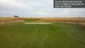
Past the golf course ... @41.7488,-88.4938
Deer tracks! @41.7483,-88.4936

Child of the corn. @41.7481,-88.4935


Achievements