Difference between revisions of "2011-12-24 48 9"
imported>Ekorren (Report and gallery) |
imported>FippeBot m (Location) |
||
| Line 40: | Line 40: | ||
[[Category:Expeditions with photos]] | [[Category:Expeditions with photos]] | ||
[[Category:Coordinates reached]] | [[Category:Coordinates reached]] | ||
| + | {{location|DE|BW|ES}} | ||
Latest revision as of 01:51, 13 August 2019
| Sat 24 Dec 2011 in 48,9: 48.6664341, 9.3375469 geohashing.info google osm bing/os kml crox |
Contents
Location
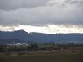
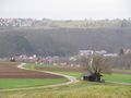
Fields in the hills above Unterensingen
Participants
Expedition
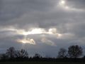
I started in the late morning by bike and went down the Neckar valley trail with a few detours and some stops to look for christmas sweets and other stuff that might already be reduced in price for the end of the season. At Neckartailfingen I left the Neckar valley, crossed the Aich valley at Grötzingen, and went up to Wolfschlugen and to the hash from there. Weather was rainy and windy, later less windy and not rainy, but never stormy like the forecast had announced, so this didn't give a reason for some special report either ;)
Gallery
A few impressions along the way
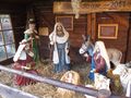
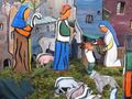
Nativity scenes are very common in Germany. Most churches will display one in december, many people set one up at home. This is a large one at Neckartenzlingen, built into a kind of dedicated hut...
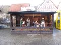
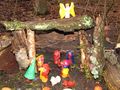
... a not that large one at Wolfschlugen built into a dry fountain...
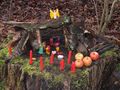
... and a small improvised one set up in the middle of the forest, for what reason ever.
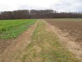
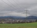
The hash is somewhere over there, near the forest
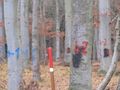
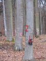
A forest of numbers!
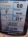
Goordinates reached
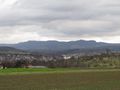
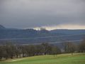
Some views from the hash