Difference between revisions of "2012-02-03 32 -116"
imported>Scerruti m (→Participants) |
imported>Jiml m (Add result codes) |
||
| Line 1: | Line 1: | ||
| − | + | [[Image:{{{image|Geohash2012020332-116.jpg}}}|thumb|left]] | |
| − | |||
| − | |||
| − | |||
| − | |||
| − | |||
| − | |||
| − | |||
{{meetup graticule | {{meetup graticule | ||
| lat=32 | | lat=32 | ||
| Line 14: | Line 7: | ||
}} | }} | ||
| − | + | ||
__NOTOC__ | __NOTOC__ | ||
== Location == | == Location == | ||
| − | + | ||
On the south shoulder of Interstate 8, 3/4 of a mile before exit 34, East Willows Rd. | On the south shoulder of Interstate 8, 3/4 of a mile before exit 34, East Willows Rd. | ||
| − | + | ||
== Participants == | == Participants == | ||
| − | + | ||
[[user:scerruti|scerruti]], A' and D* | [[user:scerruti|scerruti]], A' and D* | ||
== Plans == | == Plans == | ||
| − | + | ||
The original plan was to fully document the location and then send it out to a bunch of my Indian Guides friends who are all camping nearby this weekend. Hopefully one or two would stop or even arrange to meet at as specific time. These plans were shattered by a failed per chord on my laptop that crippled my communication capabilities. | The original plan was to fully document the location and then send it out to a bunch of my Indian Guides friends who are all camping nearby this weekend. Hopefully one or two would stop or even arrange to meet at as specific time. These plans were shattered by a failed per chord on my laptop that crippled my communication capabilities. | ||
| Line 32: | Line 25: | ||
== Expedition == | == Expedition == | ||
| − | + | ||
| − | Leaving home later than expected without any friends in tow, A' and D*, my offspring, drove to the hashed point. Normally i would have gotten out of the vehicle and taken pictures and perhaps done a jig but darkness and a busy Interstate precluded those activities. The | + | Leaving home later than expected without any friends in tow, A' and D*, my offspring, drove to the hashed point. Normally i would have gotten out of the vehicle and taken pictures and perhaps done a jig but darkness and a busy Interstate precluded those activities. The hash point being achieved within the margin of error for my equipment we rolled on. |
== Tracklog == | == Tracklog == | ||
| Line 39: | Line 32: | ||
== Photos == | == Photos == | ||
| − | + | ||
| − | + | ||
| − | |||
<gallery perrow="5"> | <gallery perrow="5"> | ||
| Line 49: | Line 41: | ||
== Achievements == | == Achievements == | ||
{{#vardefine:ribbonwidth|800px}} | {{#vardefine:ribbonwidth|800px}} | ||
| − | + | ||
| + | * Land geohash | ||
| + | * Speed racer? | ||
| + | * Drag Alongs? | ||
| Line 56: | Line 51: | ||
[[Category:New report]] | [[Category:New report]] | ||
| − | + | [[Category:Expeditions]] | |
| − | |||
| − | [[Category: | ||
| − | |||
| − | |||
| − | |||
| − | |||
[[Category:Expeditions with photos]] | [[Category:Expeditions with photos]] | ||
| − | |||
| − | |||
| − | |||
| − | |||
| − | |||
[[Category:Coordinates reached]] | [[Category:Coordinates reached]] | ||
| − | |||
| − | |||
| − | |||
| − | |||
| − | |||
| − | |||
| − | |||
| − | |||
| − | |||
| − | |||
Revision as of 18:36, 4 February 2012

| Fri 3 Feb 2012 in 32,-116: 32.8384373, -116.7004557 geohashing.info google osm bing/os kml crox |
Location
On the south shoulder of Interstate 8, 3/4 of a mile before exit 34, East Willows Rd.
Participants
scerruti, A' and D*
Plans
The original plan was to fully document the location and then send it out to a bunch of my Indian Guides friends who are all camping nearby this weekend. Hopefully one or two would stop or even arrange to meet at as specific time. These plans were shattered by a failed per chord on my laptop that crippled my communication capabilities.
In addition my packing was delayed posing my departure from home out far enough that i nearly decided to wait until tomorrow to bake the drive to camp. I was then asked to bring an important item out to camp tonight so the stop was on, just much later than planned.
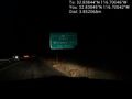
Expedition
Leaving home later than expected without any friends in tow, A' and D*, my offspring, drove to the hashed point. Normally i would have gotten out of the vehicle and taken pictures and perhaps done a jig but darkness and a busy Interstate precluded those activities. The hash point being achieved within the margin of error for my equipment we rolled on.
Tracklog
Photos
Made it @32.8384,-116.7004

Achievements
- Land geohash
- Speed racer?
- Drag Alongs?