Difference between revisions of "2012-05-17 59 19"
imported>Cjk (→Photos) |
imported>Cjk |
||
| Line 79: | Line 79: | ||
{{#vardefine:ribbonwidth|800px}} | {{#vardefine:ribbonwidth|800px}} | ||
<!-- Add any achievement ribbons you earned below, or remove this section --> | <!-- Add any achievement ribbons you earned below, or remove this section --> | ||
| − | + | {{Virgin graticule | latitude = 58 | longitude = 16 | date = 2012-01-13 | name = [[User:Per S|Per S]], [[User:Cjk|Carl-Johan]] [[User:TheFashionStatement|TheFashionStatement]] | image = 2012-05-17_59_19_20-05-14-991.jpg }} | |
| − | [[ | ||
| − | |||
<!-- An actual expedition: | <!-- An actual expedition: | ||
| − | |||
| − | |||
| − | |||
[[Category:Expeditions with videos]] | [[Category:Expeditions with videos]] | ||
[[Category:Expedition without GPS]] | [[Category:Expedition without GPS]] | ||
--> | --> | ||
| − | + | [[Category:Expeditions]] | |
| + | [[Category:Expeditions with photos]] | ||
| + | [[Category:Coordinates reached]] | ||
| + | |||
<!-- if you reached your coords: | <!-- if you reached your coords: | ||
| − | |||
--> | --> | ||
Revision as of 19:01, 17 May 2012
| Thu 17 May 2012 in 59,19: 59.7491023, 19.0242625 geohashing.info google osm bing/os kml crox |
Location
In a field 10 miles east of Norrtälje, Sweden.
Participants
Plans
- As tomorrow is Ascension Day which is a public holiday in Sweden, I have the day off. I will drive up there around noon. -- Per S
- I'll leave in my car from Stockholm around noon -- Cjk 05:37, 17 May 2012 (EDT)
Expedition
- Försten dit! -- Per S 15:43, 16 May 2012 (CEST)
- I'll be there! -- Cjk 16:16, 16 May 2012 (CEST)
- Made it. Deflowered. -- Cjk @59.7491,19.0243 13:47, 17 May 2012 (CEST)
Expedition Cjk and TheFashionStatement
Per S and I had talked about deflowering Kapellskär (it is like 99% ocean) last time we met at the hash on Utö and he found this one and sent a message via the wiki. Of course I was going. Headed off from home to pick up TheFasionStatement on the pretense that it was a road trip. And it turned out to be a nice one. The GPS in the phone was on the fritz all the way so turn off points where a bit hard to find. Got close to the right field after about an hours drive and Per S was already there, the little Early Bird that he is. Big thanks for waiting an hour for us at the hash.
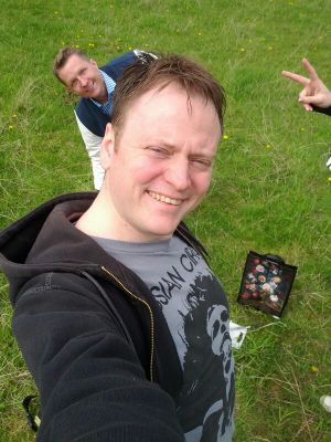
He had put up a sign on the nearest tree and built a little mound of branches on the spot. I packed up a small picnic with cutlery from home and some cheese and hard bread, Gruyere and Saint Agur. Per S had to speed off so we took a quick group photo and he took off.
Stayed some more minutes and took more photos before heading back. Had late lunch at Max and then road tripped a bit through Danderyd looking at houses and imagining the people in them. Then home to Stockholm and a quick visit to the Army Museum.
Tracklog
map of ride back to Stockholm via Max Hamburgers and a drive around Danderyd.
Photos
Hashtree @59.7489,19.0242
View of the hash @59.7489,19.0242
Orange™ @59.7491,19.0243
Achievements


