Difference between revisions of "2012-06-24 48 9"
imported>Ekorren (Reached. Template only by now, more to be added later) |
imported>Ekorren (Better late than never?) |
||
| Line 15: | Line 15: | ||
== Expedition == | == Expedition == | ||
| + | Note that this report has been written about two years after the expedition. Memory is a bit blurry at this time. | ||
| + | |||
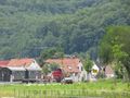
| + | Obviously I used the summer sunday train network to cross the Schwäbische Alb mountains and get to Schelklingen. From there I went by bike through a rather narrow valley (might even call it a canyon), visited the [http://www.sontheimer-hoehle.de/ ''Sontheimer Höhle''] (a dripstone cave... didn't make any photos down there, though), then continued through the former military training ground to Münsingen and visited the hash which was located somewhere in a forest. My way then led me down to Bad Urach and Metzingen, from where I went back home by train. | ||
== Gallery == | == Gallery == | ||
<gallery> | <gallery> | ||
| + | File:2012-06-24_48_9_01_trains.JPG|Vintage trains on the sunday excursion network, at Münsingen | ||
| + | File:2012-06-24_48_9_02_trains.JPG| | ||
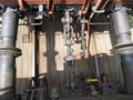
| + | File:2012-06-24_48_9_03_train_inside.JPG|inside | ||
| + | File:2012-06-24_48_9_04_tracks_switches.JPG|rusty tracks along the way | ||
| + | File:2012-06-24_48_9_05_bike_car.JPG|Bike transport on an old freight car | ||
| + | File:2012-06-24_48_9_06_coupling.JPG| | ||
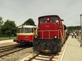
| + | File:2012-06-24_48_9_07_train.JPG|Train has left Schelklingen to go back up to Münsingen | ||
| + | File:2012-06-24_48_9_08_train.JPG| | ||
| + | File:2012-06-24_48_9_09_wegweiser.JPG|Vintage signpost | ||
| + | File:2012-06-24_48_9_10_Sheeeep.JPG|Sheeeep! | ||
| + | File:2012-06-24_48_9_11_hashpoint.JPG|The hashpoint | ||
| + | File:2012-06-24_48_9_12_hashpoint.JPG|Or this? | ||
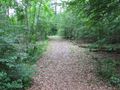
| + | File:2012-06-24_48_9_11_road.JPG|Some road | ||
| + | File:2012-06-24_48_9_13_way_to_Seeburg.JPG|Down the canyon to Bad Urach | ||
</gallery> | </gallery> | ||
Revision as of 07:34, 3 May 2014
| Sun 24 Jun 2012 in 48,9: 48.3918425, 9.4812542 geohashing.info google osm bing/os kml crox |
Contents
Location
Münsingen, a piece of forest
Participants
Ekorren went there
Expedition
Note that this report has been written about two years after the expedition. Memory is a bit blurry at this time.
Obviously I used the summer sunday train network to cross the Schwäbische Alb mountains and get to Schelklingen. From there I went by bike through a rather narrow valley (might even call it a canyon), visited the Sontheimer Höhle (a dripstone cave... didn't make any photos down there, though), then continued through the former military training ground to Münsingen and visited the hash which was located somewhere in a forest. My way then led me down to Bad Urach and Metzingen, from where I went back home by train.
Gallery
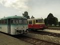
Vintage trains on the sunday excursion network, at Münsingen
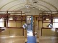
inside
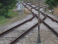
rusty tracks along the way
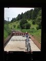
Bike transport on an old freight car
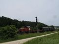
Train has left Schelklingen to go back up to Münsingen
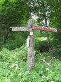
Vintage signpost
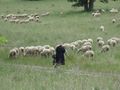
Sheeeep!
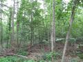
The hashpoint
Or this?
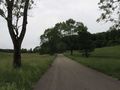
Some road
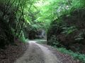
Down the canyon to Bad Urach


