Difference between revisions of "2012-07-04 47 -122"
imported>Thomcat (Expedition report) |
imported>Thomcat (Added photos) |
||
| Line 10: | Line 10: | ||
== Participants == | == Participants == | ||
| − | [[User:Thomcat|Thomcat]] | + | :[[User:Thomcat|Thomcat]] |
| − | [[User:OtherJack|OtherJack]] | + | :[[User:OtherJack|OtherJack]] |
== Plans == | == Plans == | ||
| Line 32: | Line 32: | ||
== Photos == | == Photos == | ||
<gallery> | <gallery> | ||
| + | Image:2012-07-04_47_-122_CommunitySign.jpg | Now entering... | ||
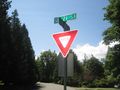
| + | Image:2012-07-04_47_-122_Intersection.jpg | The intersection | ||
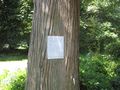
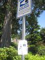
| + | Image:2012-07-04_47_-122_NotGeohashSign.jpg | This sign was not for geohashing | ||
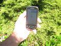
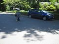
| + | Image:2012-07-04_47_-122_OnTheSpot.jpg | Blurry, but here we are! | ||
| + | Image:2012-07-04_47_-122_ChalkNearby.jpg | My son writes nearby | ||
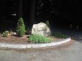
| + | Image:2012-07-04_47_-122_NearbySignpost.jpg | This signpost was convenient... | ||
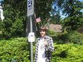
| + | Image:2012-07-04_47_-122_DetailWithFlags.jpg | ... for my sign, with flags! | ||
| + | Image:2012-07-04_47_-122_Geohasher.jpg | The happy geohasher | ||
| + | Image:2012-07-04_47_-122_Son.jpg | His crazy son | ||
Image:2012-07-04_47_-122_12-19-53-785.jpg | [http://www.openstreetmap.org/?lat=47.59079505&lon=-122.07381430&zoom=16&layers=B000FTF @47.5908,-122.0738] | Image:2012-07-04_47_-122_12-19-53-785.jpg | [http://www.openstreetmap.org/?lat=47.59079505&lon=-122.07381430&zoom=16&layers=B000FTF @47.5908,-122.0738] | ||
</gallery> | </gallery> | ||
Revision as of 23:10, 4 July 2012
| Wed 4 Jul 2012 in 47,-122: 47.5908082, -122.0739284 geohashing.info google osm bing/os kml crox |
Location
At the Y junction of three streets in Sammamish, Washington, U!S!A!
Participants
Plans
I'm thinking I'll hit this one earlier than usual, to accommodate bbqing/drinking later. I'll say 1pm by default, though you can suggest earlier or later of course. --OtherJack 23:27, 3 July 2012 (EDT)
Make that 2pm, actually --OtherJack 13:48, 4 July 2012 (EDT)
Expedition
Scoping this out on July 3 mid-morning, I said "This can be done." After dropping my daughter off at a 4 hour clay camp, I changed that to "This will be done!", nabbed my son and out the door we went. I was in such a haste I didn't check the expedition page first to see that I might have company... or not, since we couldn't stay that late.
First use of Geohash Droid to post to the site, also, which leads to posts like
- We have arrived! -- Thomcat @47.5908,-122.0739 12:12, 4 July 2012 (PDT)
Cute. Photo taken (below) was rotated, and I couldn't figure out how to fix that - maybe I have to fix in the gallery first? Not sure. Anyhow, back to the expedition!
AG thoughtfully gave us a street address, so I used both the in-car Nav and the GeohashDroid to take me right to where I wanted to be - piece of cake. Or perhaps slice of pie, this being the holiday and all. A small dog just NE of the hash was barking furiously at us, but we ignored it and went about taking measurements, chalking the street and tree, and generally enjoying things. Somebody had used tape to put a sign up on the pole and the tape was all that remained, so I reused that for the AG poster.
Geohash successful, we headed back off the plateau and home. Will Jack notice the two large bags of garbage we found? Could be a chance for a geotrash hash! --Thomcat 18:43, 4 July 2012 (EDT)
Photos
Now entering...
The intersection
This sign was not for geohashing
Blurry, but here we are!
My son writes nearby
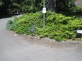
This signpost was convenient...
... for my sign, with flags!

The happy geohasher
His crazy son


