Difference between revisions of "2012-12-29 -35 149"
imported>1PE |
imported>1PE |
||
| Line 1: | Line 1: | ||
<!-- If you did not specify these parameters in the template, please substitute appropriate values for IMAGE, LAT, LON, and DATE (YYYY-MM-DD format) | <!-- If you did not specify these parameters in the template, please substitute appropriate values for IMAGE, LAT, LON, and DATE (YYYY-MM-DD format) | ||
| − | [[Image:{{{image| | + | [[Image:{{{image|2013-01-03_12.08.03_-35_149.jpg}}}|thumb|left]] |
Remove this section if you don't want an image at the top (left) of your report. You should remove the "Image:" or "File:" | Remove this section if you don't want an image at the top (left) of your report. You should remove the "Image:" or "File:" | ||
| Line 26: | Line 26: | ||
== Expedition == | == Expedition == | ||
===[[User:1PE|1PE]]=== | ===[[User:1PE|1PE]]=== | ||
| − | I needed to charge the battery of my go-to-work vehicle. Accordingly, I had a colleague jump-start the car from his car battery and I then went off on what I expected would be about 60 minutes of driving. | + | On 2012-01-03, I needed to charge the battery of my go-to-work vehicle. Accordingly, I had a colleague jump-start the car from his car battery and I then went off on what I expected would be about 60 minutes of driving. |
Having headed in the 'wrong' direction, towards the north-east, I recalled seeing a hash in the southern suburbs, pulled over and left the engine runnign while I went through the street maps and found the area where the has was; I recognised the cul-de-sacs near the major road (Sulwood Drive). So, I then headed in that direction. 30 minutes or so later, I was at the four cul-de-sacs and drove down each looking for what I rememberes: a tree near the north-west side of the street, near the top of the street, with a house on an angle nearby. I found what I thought was the hash in Shaw Place, parked the car with the engine still running, and took some pictures. Back at the office, I found that the correct hash was two cul-de-sacs to the east in Provis Place, which I had driven along and so been no more than about 3m from the hash. | Having headed in the 'wrong' direction, towards the north-east, I recalled seeing a hash in the southern suburbs, pulled over and left the engine runnign while I went through the street maps and found the area where the has was; I recognised the cul-de-sacs near the major road (Sulwood Drive). So, I then headed in that direction. 30 minutes or so later, I was at the four cul-de-sacs and drove down each looking for what I rememberes: a tree near the north-west side of the street, near the top of the street, with a house on an angle nearby. I found what I thought was the hash in Shaw Place, parked the car with the engine still running, and took some pictures. Back at the office, I found that the correct hash was two cul-de-sacs to the east in Provis Place, which I had driven along and so been no more than about 3m from the hash. | ||
| Line 35: | Line 35: | ||
--> | --> | ||
<gallery perrow="5"> | <gallery perrow="5"> | ||
| + | Image:2013-01-03_12.08.03_-35_149.jpg|Wrong day, wrong place. | ||
</gallery> | </gallery> | ||
| − | |||
== Achievements == | == Achievements == | ||
| Line 53: | Line 53: | ||
[[Category:Expedition without GPS]] | [[Category:Expedition without GPS]] | ||
[[Category:Coordinates reached]] | [[Category:Coordinates reached]] | ||
| − | |||
| − | |||
| − | |||
| − | |||
| − | |||
| − | |||
| − | |||
| − | |||
| − | |||
| − | |||
| − | |||
| − | |||
| − | |||
[[Category:Expeditions with photos]] | [[Category:Expeditions with photos]] | ||
| − | |||
| − | |||
| − | |||
| − | |||
| − | |||
| − | |||
| − | |||
| − | |||
| − | |||
| − | |||
| − | |||
| − | |||
| − | |||
| − | |||
| − | |||
| − | |||
| − | |||
| − | |||
| − | |||
| − | |||
| − | |||
| − | |||
Revision as of 06:38, 3 January 2013
| Sat 29 Dec 2012 in -35,149: -35.3807879, 149.0719146 geohashing.info google osm bing/os kml crox |
Location
The side of a small cul-de-sac street in north Kambah, a suburb of Canberra.
Participants
Plans
When I set out on the journey that became this hash, I had no intention of doing the hash. Hence, I have one component of the "Radio Yerevan" claim.
Expedition
1PE
On 2012-01-03, I needed to charge the battery of my go-to-work vehicle. Accordingly, I had a colleague jump-start the car from his car battery and I then went off on what I expected would be about 60 minutes of driving.
Having headed in the 'wrong' direction, towards the north-east, I recalled seeing a hash in the southern suburbs, pulled over and left the engine runnign while I went through the street maps and found the area where the has was; I recognised the cul-de-sacs near the major road (Sulwood Drive). So, I then headed in that direction. 30 minutes or so later, I was at the four cul-de-sacs and drove down each looking for what I rememberes: a tree near the north-west side of the street, near the top of the street, with a house on an angle nearby. I found what I thought was the hash in Shaw Place, parked the car with the engine still running, and took some pictures. Back at the office, I found that the correct hash was two cul-de-sacs to the east in Provis Place, which I had driven along and so been no more than about 3m from the hash.
Photos
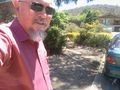
Wrong day, wrong place.

Achievements
Is it true that 1PE earned the drive-by, after no intention of going?
|