Difference between revisions of "2013-03-01 62 26"
imported>Tilley (Wrong year earlier, doh! This is correct, though.) |
imported>FippeBot m (Location) |
||
| Line 46: | Line 46: | ||
[[Category:Expeditions with photos]] | [[Category:Expeditions with photos]] | ||
[[Category:Coordinates reached]] | [[Category:Coordinates reached]] | ||
| + | {{location|FI|08}} | ||
Latest revision as of 01:11, 14 August 2019
| Fri 1 Mar 2013 in 62,26: 62.6200128, 26.2956441 geohashing.info google osm bing/os kml crox |
Location
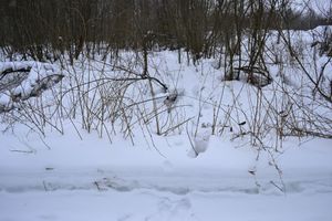
Near Konnevesi, in a wasteland near a water purifying plant.
Participants
Plans
Checking the hashpoints on the day before, I noticed that the hashpoint for this graticule landed only 500 meters astray from the route I was going to drive along with my family. Hashpoints that lie this conveniently are in my experience so rare that this is a must visit, although I had visited a hashpoint in this graticule earlier.
Expedition
Navigating to the hashpoint was very easy, we only had to take one turn from the main road and drove about 500 meters to arrive near the hashpoint. I had surveyed from the map that there was a footpath that had been marked to lead almost directly to the hashpoint. The condition of this path was of course a mystery, it could easily have been unploughed and untraversed whole winter, thus hardly giving any advantage at all. I had prepared to wade all the way, about 250 meters, in a knee-deep snow, so I was delightfully surprised that the path was ploughed very well, although the purpose of this deed remained unknown for me, perhaps it was for the benefit of the water-purifying plant. I had brough along hiking shoes and gaiters (and even forest skis, as we were going to a mini-skiing holiday), but there was no need for these now. There was only 250 meters to go, so I just parked the car, grabbed my coat and sped on my way. My daughter was sleeping so I didn't want to wake her by dragging her along.
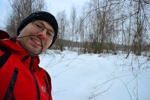
A local fellow just happened to walk in the same path towards me, and I greeted him. He looked a little surprised to see me running with a camera in one hand and gps device in another to seemingly nowhere, but did't say anything (as Finnish people usually do). Actually perhaps the path was ploughed by this fellow to give him a good place to do his morning walks? I quickly located the hashpoint, which, to my disappointment, was not directly on the path but about 20 meters to the side. I should have put on those gaiters anyway.. Well, I've been running with my feet wet in search of geohashes also earlier, and this is only a few meters.. Trudging my way to the 50 cm snow I soon noticed that there was 5 cm of icy crust on top of it and the rest was unpacked loose snow, which made going forward rather unpleasant. I made it to the hashpoint and was glad that there was only 20 meters, not 200 meters of this. Hashpoint-pose photo looks (again) rather dull, as the weather was cloudy. Indeed, this winter in middle Finland has been record-breakingly dull as the Sun has shown itself for only 35 hours during the three months of December, January and February (the average is 116 hours, which also isn't a lot).
With hashpoint scored, I left my geohash-note I had prepared earlier for the local fellow to spot and wonder once again that the city folks are crazy. I then followed my own tracks back to the path, managing to fall only once, of course to the side where I didn't have glove on from fiddling with the devices. Don't they in some kung-fu -movie harden their fists by pounding them into a bucket filled with snow? It's nothing, we Finns do that all the time!
Additional photos
Achievements
Tilley earned the Frozen Geohash Achievement
|


