Difference between revisions of "2013-05-29 50 11"
imported>Jens (Created page with "{{meetup graticule | lat=50 | lon=11 | date=2013-05-29 }} __NOTOC__ == Location == On a hill near Ammerbach == Participants == * Jens == Expedition == For a...") |
imported>Jens (→Photos) |
||
| Line 21: | Line 21: | ||
== Photos == | == Photos == | ||
| + | |||
| + | {{gallery|width=200|height=200|lines=2 | ||
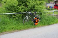
| + | |Image:130529 50 11 01.JPG|Parking area | ||
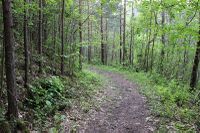
| + | |Image:130529 50 11 02.JPG|The point is on the left side of the path. Good luck. | ||
| + | |Image:130529 50 11 03.JPG|Maybe it's here... | ||
| + | |Image:130529 50 11 04.JPG|... or 6 meters away, who knows? | ||
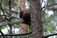
| + | |Image:130529 50 11 05.JPG|Another geohasher I met on my way back. | ||
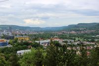
| + | |Image:130529 50 11 06.JPG|A view down the hill. | ||
| + | |Image:130529 50 11 07.JPG|And another one. | ||
| + | }} | ||
[[Category:Expeditions]] | [[Category:Expeditions]] | ||
[[Category:Expeditions with photos]] | [[Category:Expeditions with photos]] | ||
[[Category:Coordinates reached]] | [[Category:Coordinates reached]] | ||
Revision as of 19:08, 29 May 2013
| Wed 29 May 2013 in 50,11: 50.9010340, 11.5600973 geohashing.info google osm bing/os kml crox |
Location
On a hill near Ammerbach
Participants
Expedition
For a long time I was not sure, whether I will ignore this point or not. But at the end the short distance won and I decided to visit it after work. "Wetter-Online" predicted "two raindrops". That may mean everything from "cloudy but dry" till "be warned, you will be soaked", today it meant "two raindrops". That was acceptable.
It was a short way to Ammerbach by bike, where I parked it at the bottom of the hill the point lay on. From here I went the last 500 meters on foot. Good decision. Others may have tried to climb the hill by bike, but I’m not that crazy. So the last 500 meters were a relaxed walk and only the last 10 became haspoint typical.
I left the path and entered a thicket were a machete would have been helpful (once again). A cloudy sky above, trees and brushwood all around, so the GPS signal was fading of course. Whenever a moved 1 meter in reality the GPS device moved 5. And this in an area where it took 10 seconds to move this 1 meter. So a distance of 6 meters must be close enough for today’s finished-photo. (Btw. I forgot to switch on the coordinates field, but believe me, the flag is at the point)
Photos
|


