Difference between revisions of "2013-06-15 20 -155"
imported>Jiml (Add more details, cleanup) |
imported>Palmpje m (Take out markup comment) |
||
| Line 2: | Line 2: | ||
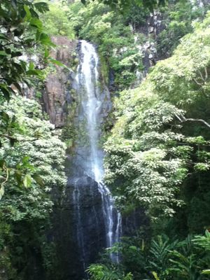
[[Image:{{{image|2013-06-15 20 -155 waterfall.jpg}}}|thumb|left]] | [[Image:{{{image|2013-06-15 20 -155 waterfall.jpg}}}|thumb|left]] | ||
| − | |||
| − | |||
| − | |||
| − | |||
{{meetup graticule | {{meetup graticule | ||
Revision as of 18:16, 16 June 2013
| Sat 15 Jun 2013 in 20,-155: 20.5175428, -155.8381667 geohashing.info google osm bing/os kml crox |
Location
In the ocean SE of Maui
Participants
Plans
Head off south and then gaze out over the ocean at the hashpoint. Maybe pick up a Retro on the way.
Expedition
Well, it was in the ocean.
Through incredible luck, I happened to be able to take a trip to Maui. Needless to say, like most geohashers, one of the thoughts that occurred to me was if I'd be able to make a hashpoint.
Originally, I wasn't going to have a rental car, but I ended up with one, and a very long drive to Hana from the main airport. I freed up enough time yesterday to go out and see the nearby area, and try to hit a couple of hashpoints. Needless to say, being a small island, most of the haspoints end up in the ocean, so I figured I'd go and gaze at today's, and see if I could make it to a nearby retro hashpoint.
The drive was very pretty, but rather nerve-racking. The one-lane bridges that I had encountered on my way to Hana turned into one-lane roads, with a cliff on the side. At least there were guard rails!
Photos
Achievements
- Mother Nature


