Difference between revisions of "2013-12-05 43 -116"
From Geohashing
imported>Eldin (inital page creation) |
imported>Eldin |
||
| Line 1: | Line 1: | ||
| − | |||
| − | |||
| − | |||
| − | |||
| − | |||
| − | |||
| − | |||
| − | |||
| − | |||
| − | |||
{{meetup graticule | {{meetup graticule | ||
| lat=43 | | lat=43 | ||
| Line 15: | Line 5: | ||
}} | }} | ||
| − | |||
__NOTOC__ | __NOTOC__ | ||
| Line 32: | Line 21: | ||
== Photos == | == Photos == | ||
| − | |||
| − | |||
| − | |||
<gallery perrow="5"> | <gallery perrow="5"> | ||
| + | File:2013-12-05 43 -116 proof.jpg | Proof of hash. | ||
| + | File:2013-12-05 43 -116 grin.jpg | Cold, but grinning. | ||
| + | File:2013-12-05 43 -116 temp.jpg | Evidence of temperature. | ||
</gallery> | </gallery> | ||
| Line 42: | Line 31: | ||
{{Land geohash|latitude=43|longitude=-116|date=2013-12-05|name=[[User:Eldin|Eldin]]}}{{Frozen Geohash|latitude=43|longitude=-116|date=2013-12-05|temperature=14°F (-10°C)|name=[[User:Eldin|Eldin]]}} | {{Land geohash|latitude=43|longitude=-116|date=2013-12-05|name=[[User:Eldin|Eldin]]}}{{Frozen Geohash|latitude=43|longitude=-116|date=2013-12-05|temperature=14°F (-10°C)|name=[[User:Eldin|Eldin]]}} | ||
| − | |||
| − | |||
| − | |||
| − | |||
| − | |||
| − | |||
| − | |||
| − | |||
| − | |||
| − | |||
[[Category:Expeditions]] | [[Category:Expeditions]] | ||
| − | |||
[[Category:Expeditions with photos]] | [[Category:Expeditions with photos]] | ||
| − | |||
| − | |||
| − | |||
| − | |||
| − | |||
[[Category:Coordinates reached]] | [[Category:Coordinates reached]] | ||
| − | |||
| − | |||
| − | |||
| − | |||
| − | |||
| − | |||
| − | |||
| − | |||
| − | |||
| − | |||
| − | |||
| − | |||
| − | |||
| − | |||
| − | |||
| − | |||
| − | |||
| − | |||
Revision as of 04:17, 6 December 2013
| Thu 5 Dec 2013 in 43,-116: 43.7411140, -116.4824167 geohashing.info google osm bing/os kml crox |
Location
In the undeveloped part of an upscale subdivision north of Star.
Participants
Expedition
This one was pretty easy to reach. I drove out to the neighborhood where the hash was located, parked about 900ft away from the hash, and walked across the somewhat hilly vacant land behind some houses to reach the hash. It was very dark, so I wasn't able to get much in the way of pictures with my cheap camera. It was also quite cold, making this my first Frozen Geohash of the winter.
Photos
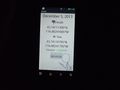
Proof of hash.

Cold, but grinning.
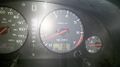
Evidence of temperature.


Achievements
Eldin earned the Land geohash achievement
|
Eldin earned the Frozen Geohash Achievement
|