Difference between revisions of "2013-12-13 43 -115"
From Geohashing
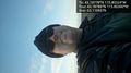
imported>Eldin ([live picture] Grin [http://www.openstreetmap.org/?lat=43.18780000&lon=-115.80300000&zoom=16&layers=B000FTF @43.1878,-115.8030]) |
imported>Eldin (add tracklog and fix categories) |
||
| Line 1: | Line 1: | ||
| − | |||
| − | |||
| − | |||
| − | |||
| − | |||
| − | |||
| − | |||
| − | |||
| − | |||
| − | |||
{{meetup graticule | {{meetup graticule | ||
| lat=43 | | lat=43 | ||
| Line 15: | Line 5: | ||
}} | }} | ||
| − | |||
__NOTOC__ | __NOTOC__ | ||
== Location == | == Location == | ||
| − | |||
== Participants == | == Participants == | ||
| − | |||
| − | |||
| − | |||
| − | |||
| − | |||
== Expedition == | == Expedition == | ||
| − | |||
*At the hash! Tracklog will follow. -- [[User:Eldin|Eldin]] ([[User talk:Eldin|talk]]) [http://www.openstreetmap.org/?lat=43.18777937&lon=-115.80324033&zoom=16&layers=B000FTF @43.1878,-115.8032] 15:58, 13 December 2013 (MST) | *At the hash! Tracklog will follow. -- [[User:Eldin|Eldin]] ([[User talk:Eldin|talk]]) [http://www.openstreetmap.org/?lat=43.18777937&lon=-115.80324033&zoom=16&layers=B000FTF @43.1878,-115.8032] 15:58, 13 December 2013 (MST) | ||
| + | |||
== Tracklog == | == Tracklog == | ||
| − | + | [[https://www.google.com/maps/ms?msid=208371759793729009228.0004ed8f8699310c70def&msa=0&ll=43.193757,-115.796456&spn=0.031381,0.075188|A track]] of the walking portion of my expedition, with the hashpoint marked. | |
== Photos == | == Photos == | ||
| − | |||
| − | |||
| − | |||
<gallery perrow="5"> | <gallery perrow="5"> | ||
| Line 46: | Line 26: | ||
== Achievements == | == Achievements == | ||
{{#vardefine:ribbonwidth|800px}} | {{#vardefine:ribbonwidth|800px}} | ||
| − | |||
| − | |||
| − | |||
| − | |||
| − | |||
| − | |||
| − | |||
| − | |||
| − | |||
| − | |||
| − | |||
[[Category:Expeditions]] | [[Category:Expeditions]] | ||
| − | |||
[[Category:Expeditions with photos]] | [[Category:Expeditions with photos]] | ||
| − | |||
| − | |||
| − | |||
| − | |||
| − | |||
[[Category:Coordinates reached]] | [[Category:Coordinates reached]] | ||
| − | |||
| − | |||
| − | |||
| − | |||
| − | |||
| − | |||
| − | |||
| − | |||
| − | |||
| − | |||
| − | |||
| − | |||
| − | |||
| − | |||
| − | |||
| − | |||
| − | |||
| − | |||
Revision as of 19:52, 15 December 2013
| Fri 13 Dec 2013 in 43,-115: 43.1877842, -115.8032356 geohashing.info google osm bing/os kml crox |
Location
Participants
Expedition
- At the hash! Tracklog will follow. -- Eldin (talk) @43.1878,-115.8032 15:58, 13 December 2013 (MST)
Tracklog
[track] of the walking portion of my expedition, with the hashpoint marked.
Photos
Grin @43.1878,-115.8030
