Difference between revisions of "2014-01-20 44 -122"
imported>Frogman (→Achievements) |
imported>Frogman (→Expedition) |
||
| Line 42: | Line 42: | ||
===Expedition 2=== | ===Expedition 2=== | ||
The road itself was blocked by a gate, but signs only indicated a restriction to vehicle access, saying nothing about pedestrians. We continued on foot up a steep gravel hill, and were able to get within 40 meters of the hashpoint. Unfortunately, the entirety of the area around the hashpoint was covered in blackberry bushes, and since it was already pretty late and we didn't have a machete or anything we decided to head back. | The road itself was blocked by a gate, but signs only indicated a restriction to vehicle access, saying nothing about pedestrians. We continued on foot up a steep gravel hill, and were able to get within 40 meters of the hashpoint. Unfortunately, the entirety of the area around the hashpoint was covered in blackberry bushes, and since it was already pretty late and we didn't have a machete or anything we decided to head back. | ||
| + | |||
| + | == Photos == | ||
| + | <!-- Insert pictures between the gallery tags using the following format: | ||
| + | Image:2012-##-## ## ## Alpha.jpg | Witty Comment | ||
| + | --> | ||
| + | <gallery perrow="5"> | ||
| + | Image:2014-01-20 44 -122 gate.jpg | Time to continue on foot! | ||
| + | Image:2014-01-20 44 -122 river.jpg | We crossed a river. | ||
| + | Image:2014-01-20 44 -122 stump.jpg | A stump. | ||
| + | Image:2014-01-20 44 -122 running.jpg | Daisy wanted to run! | ||
| + | Image:2014-01-20 44 -122 runnnnning.jpg | But then she got sad because she was so far away from everyone else. | ||
| + | Image:2014-01-20 44 -122 kate.jpg | The hill was steep. | ||
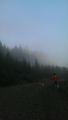
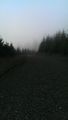
| + | Image:2014-01-20 44 -122 trees.jpg | At the top of the hill: trees! | ||
| + | Image:2014-01-20 44 -122 thwarted.jpg | We didn't feel like walking through 40 meters of blackberry bushes. | ||
| + | Image:2014-01-20 44 -122 grins.jpg | We were all smiles anyway! | ||
| + | </gallery> | ||
== Achievements == | == Achievements == | ||
Revision as of 17:23, 22 January 2014
| Mon 20 Jan 2014 in 44,-122: 44.4015294, -122.5395423 geohashing.info google osm bing/os kml crox |
Location
Just off hwy 20 east of Sweet Home.
Participants
Expedition 1
Expedition 2
- Frogman
- Alison
- Kate
Plans
- Get in my car.
- Drive to the nearby logging road.
- Figure out how to get to the hash point from the road.
Expedition
Expedition 1
Cell coverage stopped completely about 10 miles from the hash point. Since I didn't have a backup navigation scheme, I turned around and came home.
Expedition 2
The road itself was blocked by a gate, but signs only indicated a restriction to vehicle access, saying nothing about pedestrians. We continued on foot up a steep gravel hill, and were able to get within 40 meters of the hashpoint. Unfortunately, the entirety of the area around the hashpoint was covered in blackberry bushes, and since it was already pretty late and we didn't have a machete or anything we decided to head back.
Photos
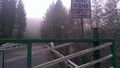
Time to continue on foot!
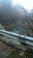
We crossed a river.
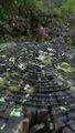
A stump.
Daisy wanted to run!
But then she got sad because she was so far away from everyone else.
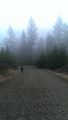
The hill was steep.
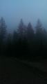
At the top of the hill: trees!
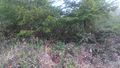
We didn't feel like walking through 40 meters of blackberry bushes.
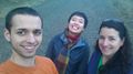
We were all smiles anyway!


Achievements
Anniepoo earned the Blinded by Science Consolation Prize
|