Difference between revisions of "2014-07-14 52 9"
From Geohashing
imported>GeorgDerReisende |
imported>GeorgDerReisende (expedition report added) |
||
| Line 20: | Line 20: | ||
== Expedition == | == Expedition == | ||
| − | |||
| − | |||
{| | {| | ||
| Line 27: | Line 25: | ||
! style="width:300px" | !! style="width:300px" | !! style="width:300px" | | ! style="width:300px" | !! style="width:300px" | !! style="width:300px" | | ||
|- | |- | ||
| − | | [[Image:2014-07-14 52 9 GeorgDerReisende 3193.jpg|300px]] || [[Image:2014-07-14 52 9 GeorgDerReisende 3196.jpg|300px]] || | + | | [[Image:2014-07-14 52 9 GeorgDerReisende 3193.jpg|300px]] || [[Image:2014-07-14 52 9 GeorgDerReisende 3196.jpg|300px]] || I left home at 11:45, started to hitchhike at 12:30, and with two cars I arrived at the service station Wülferode at 15:00. From there I had to walk ten kilometers to the hash. I passed the lock of the Mittellandkanal and it was the moment, when a ship entered the lock basin. |
|- | |- | ||
| − | | [[Image:2014-07-14 52 9 GeorgDerReisende 3206.jpg|300px]] || [[Image:2014-07-14 52 9 GeorgDerReisende 3207.jpg|300px]] || | + | | [[Image:2014-07-14 52 9 GeorgDerReisende 3206.jpg|300px]] || [[Image:2014-07-14 52 9 GeorgDerReisende 3207.jpg|300px]] || Shortly after I visited a point besides an industrial area. This point is important for me, because there I learned about plot boundaries. While at school I had a practical course at the surveyor's office of the city of Hannover. At some days I accompanied the surveyors at their work. One work was to reset the border stone of a field. I wondered about the site, because the place of the stone was on the field, not at its edge. I was told, that a farmer has to hold free the edge of the field, for that people can walk along the fields. This was the reason, that I could walk to the [[2014-07-12 51 9]] hash.<br>Questions I have in this are: if a field is owned by a farmer and he uses it for several plants, am I allowed to walk along the borders of the plants or if a farmer rents some pieces of land and uses these as one whole field, may I walk along the real borders?<br>Today the stone lies on a fieldway which leads around the industrial area. |
|- | |- | ||
| − | | [[Image:2014-07-14 52 9 GeorgDerReisende 3218.jpg|300px]] || [[Image:2014-07-14 52 9 GeorgDerReisende 3223.jpg|300px]] || | + | | [[Image:2014-07-14 52 9 GeorgDerReisende 3218.jpg|300px]] || [[Image:2014-07-14 52 9 GeorgDerReisende 3223.jpg|300px]] || Then I walked along the Höversche Straße ... |
|- | |- | ||
| − | | [[Image:2014-07-14 52 9 GeorgDerReisende 3235.jpg|300px]] || [[Image:2014-07-14 52 9 GeorgDerReisende 3241.jpg|300px]] || | + | | [[Image:2014-07-14 52 9 GeorgDerReisende 3235.jpg|300px]] || [[Image:2014-07-14 52 9 GeorgDerReisende 3241.jpg|300px]] || ... the Anderter Straße ... |
|- | |- | ||
| − | | [[Image:2014-07-14 52 9 GeorgDerReisende | + | | [[Image:2014-07-14 52 9 GeorgDerReisende 3247.jpg|300px]] || [[Image:2014-07-14 52 9 GeorgDerReisende 3251.jpg|300px]] || ... the Waldstraße, crossed the Wietzegraben and ended in the street Am Fahrhorstfelde. |
|- | |- | ||
| − | | [[Image:2014-07-14 52 9 GeorgDerReisende 3254.jpg|300px]] || [[Image:2014-07-14 52 9 GeorgDerReisende 3255.jpg|300px]] || | + | | [[Image:2014-07-14 52 9 GeorgDerReisende 3254.jpg|300px]] || [[Image:2014-07-14 52 9 GeorgDerReisende 3255.jpg|300px]] || Then I entered the forest. Near the hash I found an informal way into the forest. |
|- | |- | ||
| − | | [[Image:2014-07-14 52 9 GeorgDerReisende 3257.jpg|300px]] || [[Image:2014-07-14 52 9 GeorgDerReisende 3258.jpg|300px]] || | + | | [[Image:2014-07-14 52 9 GeorgDerReisende 3257.jpg|300px]] || [[Image:2014-07-14 52 9 GeorgDerReisende 3258.jpg|300px]] || I followed this way and came near to the hash, then I found the hash to be in a field of ferns. Later I found out, that it would have been easier to walk around this field. |
|- | |- | ||
| − | | [[Image:2014-07-14 52 9 GeorgDerReisende 3263.jpg|300px]] || [[Image:2014-07-14 52 9 GeorgDerReisende 3264.jpg|300px]] || | + | | [[Image:2014-07-14 52 9 GeorgDerReisende 3263.jpg|300px]] || [[Image:2014-07-14 52 9 GeorgDerReisende 3264.jpg|300px]] || While dancing around in the forest, I found out that there was a tree on the hash. |
|- | |- | ||
| − | | [[Image:2014-07-14 52 9 GeorgDerReisende 3265.jpg|300px]] || [[Image:2014-07-14 52 9 GeorgDerReisende 3266.jpg|300px]] || | + | | [[Image:2014-07-14 52 9 GeorgDerReisende 3265.jpg|300px]] || [[Image:2014-07-14 52 9 GeorgDerReisende 3266.jpg|300px]] || This is the tree, I wrote the mark onto it. |
|- | |- | ||
| − | | [[Image:2014-07-14 52 9 GeorgDerReisende 3267.jpg|300px]] || || | + | | [[Image:2014-07-14 52 9 GeorgDerReisende 3267.jpg|300px]] || || The geohasher. |
|- | |- | ||
| − | | [[Image:2014-07-14 52 9 GeorgDerReisende 3268.jpg|300px]] || [[Image:2014-07-14 52 9 GeorgDerReisende 3269.jpg|300px]] || | + | | [[Image:2014-07-14 52 9 GeorgDerReisende 3268.jpg|300px]] || [[Image:2014-07-14 52 9 GeorgDerReisende 3269.jpg|300px]] || Look around into the forest: ferns. |
|} | |} | ||
| Line 54: | Line 52: | ||
<!-- Add any achievement ribbons you earned below, or remove this section --> | <!-- Add any achievement ribbons you earned below, or remove this section --> | ||
| + | {{Thumbs Up | latitude = 52 | longitude = 9 | date = 2014-07-14 | name = GeorgDerReisende }} | ||
[[Category:Expeditions]] | [[Category:Expeditions]] | ||
Revision as of 18:45, 21 July 2014
| Mon 14 Jul 2014 in 52,9: 52.4024204, 9.8453082 geohashing.info google osm bing/os kml crox |
Location
The hash lied in the forest of Hannover-Misburg.
Participants
Plans
Hitchhiking and walking. Some special surveillance.
Expedition
 |
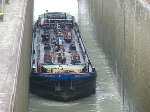 |
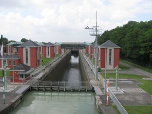
I left home at 11:45, started to hitchhike at 12:30, and with two cars I arrived at the service station Wülferode at 15:00. From there I had to walk ten kilometers to the hash. I passed the lock of the Mittellandkanal and it was the moment, when a ship entered the lock basin. |
 |
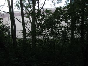 |
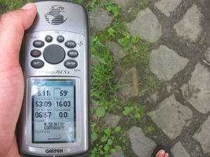
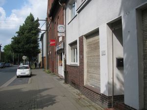
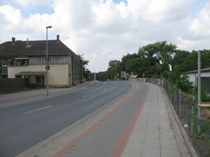
Shortly after I visited a point besides an industrial area. This point is important for me, because there I learned about plot boundaries. While at school I had a practical course at the surveyor's office of the city of Hannover. At some days I accompanied the surveyors at their work. One work was to reset the border stone of a field. I wondered about the site, because the place of the stone was on the field, not at its edge. I was told, that a farmer has to hold free the edge of the field, for that people can walk along the fields. This was the reason, that I could walk to the 2014-07-12 51 9 hash. Questions I have in this are: if a field is owned by a farmer and he uses it for several plants, am I allowed to walk along the borders of the plants or if a farmer rents some pieces of land and uses these as one whole field, may I walk along the real borders? Today the stone lies on a fieldway which leads around the industrial area. |
 |
 |
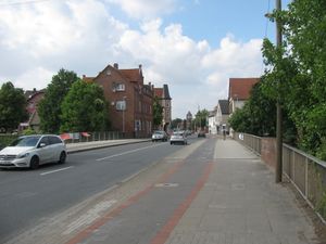
Then I walked along the Höversche Straße ... |
 |
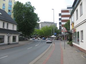 |
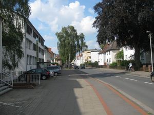
... the Anderter Straße ... |
 |
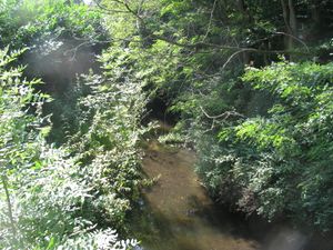 |
... the Waldstraße, crossed the Wietzegraben and ended in the street Am Fahrhorstfelde. |
 |
 |
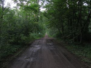
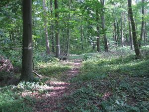
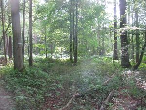
Then I entered the forest. Near the hash I found an informal way into the forest. |
 |
 |
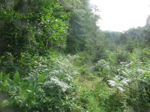
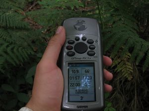
I followed this way and came near to the hash, then I found the hash to be in a field of ferns. Later I found out, that it would have been easier to walk around this field. |
 |
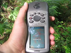 |
While dancing around in the forest, I found out that there was a tree on the hash. |
 |
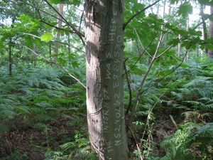 |
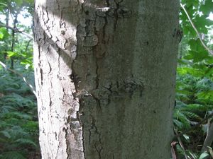
This is the tree, I wrote the mark onto it. |
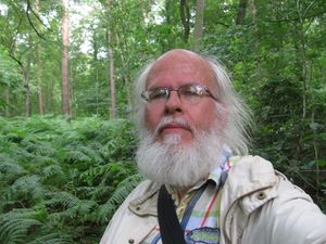 |
The geohasher. | |
 |
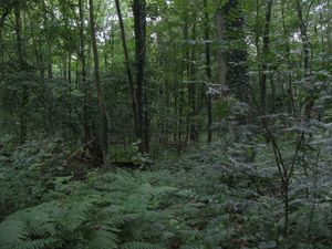 |
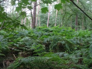
Look around into the forest: ferns. |
Achievements
GeorgDerReisende earned the Thumbs Up Geohash Achievement
|