Difference between revisions of "2014-09-01 42 -78"
imported>Pedalpusher (Created page with "{{subst:Expedition |lat = 42 |lon = -78 |date = 2014-09-01 }}") |
imported>Pedalpusher |
||
| Line 1: | Line 1: | ||
| − | |||
| − | |||
| − | |||
| − | |||
| − | |||
| − | |||
| − | |||
| − | |||
| − | |||
--> | --> | ||
{{meetup graticule | {{meetup graticule | ||
| Line 18: | Line 9: | ||
__NOTOC__ | __NOTOC__ | ||
== Location == | == Location == | ||
| − | + | Allegany State Park | |
== Participants == | == Participants == | ||
| − | + | * [[User:Pedalpusher|Pedalpusher]] | |
| − | + | * Wife of Pedalpusher | |
| + | * Simon the dog | ||
| + | * Myka the dog | ||
== Plans == | == Plans == | ||
| − | + | Initial plans were to take Simon the dog to the park and have a picnic at the hash. Then go on a longer hike after. The wife decided that wasn't fair to Myka the dog and decided to come too. | |
== Expedition == | == Expedition == | ||
| − | + | After getting some work done around the house, we packed up the car and headed to Allegany around 13:00. We arrived at the park a little before 14:00 and paid the $7 entrance fee. Fortunately for Pedalpusher's wife the hash was actually close to the road(about a half mile) and also right by a horse trail. We parked the car at the trail-head and headed into the woods. A short way in, we crossed the stream using a bridge(which I was hoping to find) and the dogs enjoyed the water. They certainly earned the drowned rat achievement, while we were happy to not have to wade through ankle deep water. Past the creek, we were then able to follow the trail a bit as it was heading in the right direction. When the horse trail turned, with about .4 miles to go, we discovered that we could then follow very old logging roads. At this point, the going started to get a bit soggy and the wife stepped in a few muddy spots and ended up with squishy feet. A tenth of a mile closer we came to a small open meadow which turned out to have soggy, muddy ground too. It was slow going but the wife was pushing on. With about .2 miles to go, the valley we were following started to turn and we had to cross another creek and start heading up a fairly steep hill. Pedalpusher knew it was only a matter of time and was hoping the wife could make it just a little bit further. Unfortunately, with .13 miles to the hash, the wife was done and couldn't continue. Fortunately, since it was so close, she allowed Pedalpusher to continue up the hill in search of the hash and avoid the Nanny Consolation. With the dogs in tow, we made it almost to the very top and the hash was by a small group of small trees. The GPS counted down to within 1.8 feet of the hash but of course it lost the signal when it was put down to get the camera. Even with the GPS dance, there must not have been enough satellites after that for a more accurate reading than what I finally got a picture of. Proof taken and waiting wife below, we headed back the way we came. <br> | |
| − | + | With the wife done hiking for the day, she agreed to hang out and people-watch at the general store while the dogs and I went on a trail hike. We walked maybe 2 miles or so(one way) of the Bear Caves trail and then headed back to the store for Ice-cream. It turns out that the ice-cream shop closed at 15:00 so we had to do without on the way home. | |
| − | |||
| − | |||
== Photos == | == Photos == | ||
| Line 38: | Line 29: | ||
--> | --> | ||
<gallery perrow="5"> | <gallery perrow="5"> | ||
| + | Image:2014-09-01_Admit-one.jpg| Receipt for access | ||
</gallery> | </gallery> | ||
== Achievements == | == Achievements == | ||
{{#vardefine:ribbonwidth|800px}} | {{#vardefine:ribbonwidth|800px}} | ||
| − | + | {{Admit One geohash | |
| − | + | | latitude = 42 | |
| + | | longitude = -78 | ||
| + | | date = 2014-09-01 | ||
| + | | name = Pedalpusher | ||
| + | | price = $7 | ||
| + | | venue = Allegany State Park | ||
| + | }} | ||
| + | {{drag-along | ||
| + | | latitude = 42 | ||
| + | | longitude = -78 | ||
| + | | date = 2014-09-01 | ||
| + | | partner = his wife within 0.13 miles | ||
| + | | name = Pedalpusher | ||
| + | }} | ||
| + | {{mnb geohash | ||
| + | | latitude = 42 | ||
| + | | longitude = -78 | ||
| + | | date = 2014-09-01 | ||
| + | | name = Pedalpusher's wife | ||
| + | }} | ||
| − | |||
| − | |||
| − | |||
| − | |||
| − | |||
| − | |||
| − | |||
| − | |||
| − | |||
| − | |||
| − | |||
[[Category:Expeditions]] | [[Category:Expeditions]] | ||
| − | + | [[Category:Expeditions with dogs]] | |
[[Category:Expeditions with photos]] | [[Category:Expeditions with photos]] | ||
| − | |||
| − | |||
| − | |||
| − | |||
| − | |||
[[Category:Coordinates reached]] | [[Category:Coordinates reached]] | ||
| − | |||
| − | |||
| − | |||
| − | |||
| − | |||
| − | |||
| − | |||
| − | |||
| − | |||
| − | |||
| − | |||
| − | |||
| − | |||
| − | |||
| − | |||
| − | |||
| − | |||
| − | |||
Revision as of 15:54, 2 September 2014
-->
| Mon 1 Sep 2014 in 42,-78: 42.0341211, -78.7300125 geohashing.info google osm bing/os kml crox |
Location
Allegany State Park
Participants
- Pedalpusher
- Wife of Pedalpusher
- Simon the dog
- Myka the dog
Plans
Initial plans were to take Simon the dog to the park and have a picnic at the hash. Then go on a longer hike after. The wife decided that wasn't fair to Myka the dog and decided to come too.
Expedition
After getting some work done around the house, we packed up the car and headed to Allegany around 13:00. We arrived at the park a little before 14:00 and paid the $7 entrance fee. Fortunately for Pedalpusher's wife the hash was actually close to the road(about a half mile) and also right by a horse trail. We parked the car at the trail-head and headed into the woods. A short way in, we crossed the stream using a bridge(which I was hoping to find) and the dogs enjoyed the water. They certainly earned the drowned rat achievement, while we were happy to not have to wade through ankle deep water. Past the creek, we were then able to follow the trail a bit as it was heading in the right direction. When the horse trail turned, with about .4 miles to go, we discovered that we could then follow very old logging roads. At this point, the going started to get a bit soggy and the wife stepped in a few muddy spots and ended up with squishy feet. A tenth of a mile closer we came to a small open meadow which turned out to have soggy, muddy ground too. It was slow going but the wife was pushing on. With about .2 miles to go, the valley we were following started to turn and we had to cross another creek and start heading up a fairly steep hill. Pedalpusher knew it was only a matter of time and was hoping the wife could make it just a little bit further. Unfortunately, with .13 miles to the hash, the wife was done and couldn't continue. Fortunately, since it was so close, she allowed Pedalpusher to continue up the hill in search of the hash and avoid the Nanny Consolation. With the dogs in tow, we made it almost to the very top and the hash was by a small group of small trees. The GPS counted down to within 1.8 feet of the hash but of course it lost the signal when it was put down to get the camera. Even with the GPS dance, there must not have been enough satellites after that for a more accurate reading than what I finally got a picture of. Proof taken and waiting wife below, we headed back the way we came.
With the wife done hiking for the day, she agreed to hang out and people-watch at the general store while the dogs and I went on a trail hike. We walked maybe 2 miles or so(one way) of the Bear Caves trail and then headed back to the store for Ice-cream. It turns out that the ice-cream shop closed at 15:00 so we had to do without on the way home.
Photos
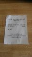
Receipt for access

Achievements

Pedalpusher earned the Drag-along achievement
|