Difference between revisions of "2014-10-05 48 7"
From Geohashing
imported>Q-Owl m |
imported>Q-Owl m (→Participants) |
||
| Line 21: | Line 21: | ||
*[[User:Q-Owl|Q-Owl]] | *[[User:Q-Owl|Q-Owl]] | ||
| − | *Q-Owla | + | *[[User:Q-Owla|Q-Owla]] |
== Plan == | == Plan == | ||
Revision as of 07:03, 11 March 2015
| Sun 5 Oct 2014 in 48,7: 48.8552437, 7.4615440 geohashing.info google osm bing/os kml crox |
Location
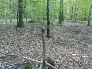
In a little wood between Bouxwiller and Ingwiller (Alsace, France).
Participants
Plan
Drive by car to the hash area and walk to the hashpoint.
Expedition
We drove near the hashpoint and had a nice walk through an orchard with apple trees and walnut trees. Q-Owla stayed in the orchard and I made my way into the wood to the hp.
The coordinates were not easy to find under the big beech trees. 3 or 4 m was the best result during a 15 minute dance. Good enough under those trees. Marking the hp, taking photos, back to Q-Owla and happy grin. :-) :-)
Photos
Achievements / Honorable Mention
Q-Owl earned the Land geohash achievement
|
Q-Owl earned the Drag-along achievement
|
Q-Owl achieved level 2 of the Minesweeper Geohash achievement
|


