Difference between revisions of "2015-03-13 49 8"
imported>Q-Owl |
imported>Q-Owl |
||
| Line 1: | Line 1: | ||
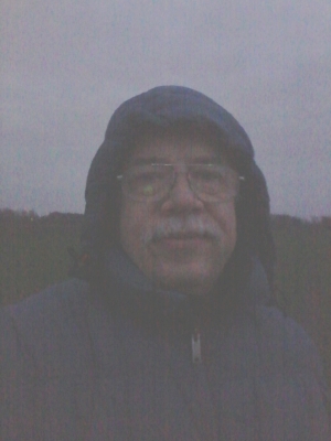
| − | + | [[Image:2015-03-13 49 8 grin.jpg|thumb|left|Grin in the dark]] | |
{{meetup graticule | {{meetup graticule | ||
| lat=49 | | lat=49 | ||
| Line 20: | Line 20: | ||
== Expedition == | == Expedition == | ||
| − | I drove home after work and drove together with my wife to [http://de.wikipedia.org/wiki/Maudach Maudach], a little | + | I drove home after work and drove together with my wife to [http://de.wikipedia.org/wiki/Maudach Maudach], a little village and part of [[wikipedia:Ludwigshafen|Ludwigshafen]]. Te hashpoint lay in the middle of the [http://de.wikipedia.org/wiki/Maudacher_Bruch Maudacher Bruch] which is a dry swamp/moor, situated in a former curve of the river Rhine (see [https://www.youtube.com/watch?v=p7L1mzdO-wQ youtube.com]). |
| − | We arrived after sunset and had a 1.5 km walk in dusk and ugly cold northwind to the hashpoint. It was easy to find (about 19:00 h) on a field, I took some Photos and we walked back to the car. | + | We arrived after sunset and had a 1.5 km walk in dusk and ugly cold northwind to the hashpoint. It was easy to find (about 19:00 h) on a field, I took some Photos and we walked back to the car. And we did the earthcache [http://coord.info/GC4230Z GC4230Z] there. |
Edit:<br>As [[User:Eupeodes|Eupeodes]] wrote, there are some Problems with the coordinates today.<br>It seems that the coordinates, my smartphone displayed, are the right ones. | Edit:<br>As [[User:Eupeodes|Eupeodes]] wrote, there are some Problems with the coordinates today.<br>It seems that the coordinates, my smartphone displayed, are the right ones. | ||
| Line 34: | Line 34: | ||
Image:2015-03-13 49 8 walk.jpg | Walk to the hashpoint and view north | Image:2015-03-13 49 8 walk.jpg | Walk to the hashpoint and view north | ||
Image:2015-03-13 49 8 proof.png | Proof | Image:2015-03-13 49 8 proof.png | Proof | ||
| + | Image:2015-03-13 49 8 view.jpg | The hp lies there in the west | ||
Image:2015-03-13 49 8 north.jpg | North | Image:2015-03-13 49 8 north.jpg | North | ||
| − | |||
| − | |||
Image:2015-03-13 49 8 west.jpg | West | Image:2015-03-13 49 8 west.jpg | West | ||
| − | Image:2015-03-13 49 8 grin.jpg | | + | Image:2015-03-13 49 8 grin.jpg | Grin in the dark |
</gallery> | </gallery> | ||
Revision as of 14:01, 14 March 2015
| Fri 13 Mar 2015 in 49,8: 49.4676646, 8.3849940 geohashing.info google osm bing/os kml crox |
Location
In the middle of the Maudacher Bruch near Ludwigshafen.
Participants
Plan
Drive by car to the hash area after work and walk to the hashpoint.
Expedition
I drove home after work and drove together with my wife to Maudach, a little village and part of Ludwigshafen. Te hashpoint lay in the middle of the Maudacher Bruch which is a dry swamp/moor, situated in a former curve of the river Rhine (see youtube.com).
We arrived after sunset and had a 1.5 km walk in dusk and ugly cold northwind to the hashpoint. It was easy to find (about 19:00 h) on a field, I took some Photos and we walked back to the car. And we did the earthcache GC4230Z there.
Edit:
As Eupeodes wrote, there are some Problems with the coordinates today.
It seems that the coordinates, my smartphone displayed, are the right ones.
Photos
Achievements / Honorable Mention
Q-Owl earned the Land geohash achievement
|


