imported>Danatar |
imported>FippeBot |
| Line 58: |
Line 58: |
| | [[Category:Coordinates reached]] | | [[Category:Coordinates reached]] |
| | [[Category:Danatar]] | | [[Category:Danatar]] |
| | + | {{location|DE|SN|GR}} |
Latest revision as of 03:50, 15 August 2019
Location
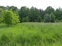
Today's location is in a small forest at Hartau, a part of Zittau. In eastern Germany, you can't go much further south-east than this, since Poland is to the (north-)east and the Czech Republic is to the south (and the east, and to the west as well but that's a bit further).
Country: Germany; state: Sachsen (Saxony, EU:DE:SN); district: Görlitz
Expedition
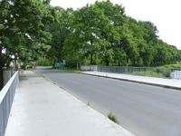
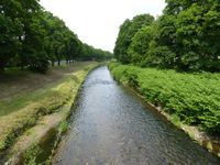
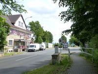
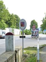
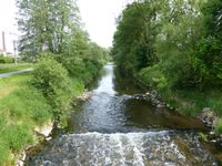
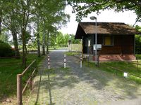
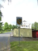
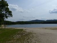
I saw that the Friday coordinates fell into the 50 14 part of Görlitz district (where I haven't been before) and there near Zittau, so it would be possible to reach the spot by public transport. First I cycled to the Dresden-Neustadt train station and took a train to Löbau. There I changed to the bus to Zittau. I rode that bus to the final stop, south of the old city center. From the bus stop (at Martin-Wehnert-Straße) the best way to the hashpoint would be to just follow the road and take a left turn after just under 5 km. But that would have been boring. Instead I took the other road for 3 km. This might sound boring as well, but it wasn't. Because on this 3 km the road went through three different countries. The first border I encountered along the way was the border between Germany (duh) and Poland. Since 1945 de facto and since 1990 de jure that border is formed by the river Neiße (and the river Oder which the Neiße flows into) which I crossed on a bridge. Thanks to the European Union, there were no guards, gates or barbed wire fences, the only indication of the border were two poles (pun semi-intended), a German one in black-red-gold on one side of the river and a Polish one in white and red. I didn't stop walking until I had left Poland again. The Czechs at least had a sign with "Czech Republic" on it. After that border I took the first turn to the right and soon I reached the Kristýna lake, a flooded former opencast pit that is used as a recreational area now. Some people were fishing. After walking around the lake I soon crossed the Neiße again. It was not the border any more, with both banks in the Czech Republic. 500 meters later I arrived at the border to Germany. There was a "Czech Republic" sign again (visible from the Germany side only) and there was also a sign on the German side. But it was not a "Germany" sign, it showed the Saxon colors.
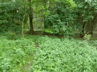
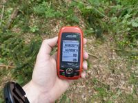
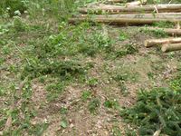
From there I only had to walk through Hartau and then I was near the hashpoint. I crossed a meadow and took some steps into the forest to find an area where many trees had been cut down. After I had taken the usual pictures I looked at the train schedule. The next viable train would be 70 minutes later or else I would have to take the bus and arrive one hour later than by train. Since I didn't think Zittau has enough interesting stuff to spend one hour (I don't mean it as bad as it sounds) I started to walk quickly towards Zittau. On the way I bought a Döner (I didn't have lunch and it was already past 16:30) and I snapped some pictures in the old city center without really stopping, so after 6.5 km I arrived at the train station with 5 minutes to spare. Yay! Enough time to buy a ticket for the way back. While buying the outbound ticket I stupidly had bought a single ticket instead of a Saxony (all-day) ticket, so the total train fares were almost 10 € (a bit more than $10) more than necessary. The Zittau train station didn't even have a ticket machine, I had to go to the ticket office. The ride home was uneventful.
While writing this report, short looking-up of various things on wikipedia turned into a "wiki walk" including among others: farm buildings, the history of Gdansk, flag variants, Free State Bottleneck...
|
Danatar earned the Border geohash achievement
- by crossing the Germany-Poland border, the Poland-Czech Republic border and the Czech Republic-Germany border on 2015-05-29 to reach the (50, 14) geohash.
|
|
| the border between Germany and Poland...
|
| the border between Poland and the Czech Republic...
|
| the Neiße again, not as a border
|
| the border between the Czech Republic and ... Saxony apparently
|
| "Free State Saxony" "here be rabies" (local dialect for 'Welcome')
|
|
tracklog
Triton tracklog
