Difference between revisions of "2015-08-03 66 24"
imported>Tilley |
imported>FippeBot m (Location) |
||
| Line 44: | Line 44: | ||
[[Category:Expeditions with photos]] | [[Category:Expeditions with photos]] | ||
[[Category:Coordinates reached]] | [[Category:Coordinates reached]] | ||
| + | {{location|FI|10}} | ||
Latest revision as of 04:40, 15 August 2019
| Mon 3 Aug 2015 in 66,24: 66.0421194, 24.7341844 geohashing.info google osm bing/os kml crox |
Location
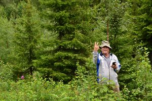
In Kolmostenperä, Tervola. The point lies in a bilberry forest.
Participants
- Pastori
- The Wife
Expedition
This is the second hashpoint of the day. The story starts here.
This point was considerably easier than the previous one. It lay about 60 metres off the Finnish national road 4 (part of the European route E75 across Europe). Pastori parked the car on a nearby back road and Pastori and Wife started their approach. The hashpoint was reached at an accuracy of 0,5 metres and completely dry this time. There were bilberries in the forest and at this latitude they were already ripe. So Pastori and Wife returned to the car contended and eating bilberries; after all, they had already reached two hashpoints on the same day. They had to walk a total of about 250 metres. They continued their journey to meet IsoPekka in his home town. After a nice little chat sharing experiences, Pastori and Wife headed towards their stop for the night and maybe towards their third hashpoint of the day.
Additional photos
Achievements
Pastori and The Wife earned the Multihash Achievement
|
Pastori and The Wife earned the Land geohash achievement
|


