Difference between revisions of "Talk:2015-08-08 52 0"
From Geohashing
imported>Sourcerer m (→Wikiloc) |
imported>Sourcerer m (→-1, 36) |
||
| Line 8: | Line 8: | ||
::Haha! I'm very relieved to report that I made a sign error - the Tongs to whom I referred are in Nairobi, which is '''-1''', 36. Now we won't have them determinedly hiking out to a mountain lake of burning lava! Have a great afternoon, hope to catch up with you all soon. --[[User:Tongs/B|Tongs/B]]. | ::Haha! I'm very relieved to report that I made a sign error - the Tongs to whom I referred are in Nairobi, which is '''-1''', 36. Now we won't have them determinedly hiking out to a mountain lake of burning lava! Have a great afternoon, hope to catch up with you all soon. --[[User:Tongs/B|Tongs/B]]. | ||
| − | : PaintedJaguar - You use [http://www.wikiloc.com/wikiloc/view.do?id=10418965 Wikiloc] - I love this site. Outside the UK (no OS Maps) it's often the best place to find walking routes. There is a "Wikiloc layer" in Google earth making it even easier to locate the tracks. --[[User:Sourcerer|Sourcerer]] ([[User talk:Sourcerer|talk]]) | + | ::: That looks totally reachable, perhaps with a 4x4 for the dirt road. Then a walk across field boundaries. |
| + | |||
| + | PaintedJaguar - You use [http://www.wikiloc.com/wikiloc/view.do?id=10418965 Wikiloc] - I love this site. Outside the UK (no OS Maps) it's often the best place to find walking routes. There is a "Wikiloc layer" in Google earth making it even easier to locate the tracks. --[[User:Sourcerer|Sourcerer]] ([[User talk:Sourcerer|talk]]) | ||
Revision as of 10:27, 9 August 2015
Sadly no Tongs can make it today. One of us is in the 50,-3 graticule and another two in the 1,36 graticule. Hopefully we'll get to meet you both this summer! Have fun! Tongs (talk) 07:20, 8 August 2015 (EDT)
- I had to look up 1, 36. Mount Silali is a dormant volcano! --Sourcerer (talk) 08:39, 8 August 2015 (EDT)
- Haha! I'm very relieved to report that I made a sign error - the Tongs to whom I referred are in Nairobi, which is -1, 36. Now we won't have them determinedly hiking out to a mountain lake of burning lava! Have a great afternoon, hope to catch up with you all soon. --Tongs/B.
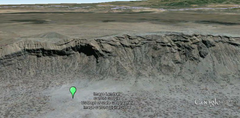
- That looks totally reachable, perhaps with a 4x4 for the dirt road. Then a walk across field boundaries.
PaintedJaguar - You use Wikiloc - I love this site. Outside the UK (no OS Maps) it's often the best place to find walking routes. There is a "Wikiloc layer" in Google earth making it even easier to locate the tracks. --Sourcerer (talk)

