Difference between revisions of "2015-08-18 55 12"
imported>Erik r (→Photos) |
imported>Erik r (→Photos) |
||
| Line 24: | Line 24: | ||
--> | --> | ||
<gallery perrow="5"> | <gallery perrow="5"> | ||
| − | Image: | + | Image:2015_08_18_55_12_view1.jpg|First view on the way |
| + | Image:2015_08_18_55_12_nursery.jpg|The Nursery Sign | ||
| + | Image:2015_08_18_55_12_view2.jpg|Almost there! | ||
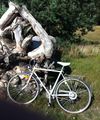
| + | Image:2015_08_18_55_12_bike.jpg|Left the bike here | ||
| + | Image:2015_08_18_55_12_hash1.jpg|There it is! | ||
| + | Image:2015_08_18_55_12_hash2.jpg|The Hashpoint | ||
| + | Image:2015_08_18_55_12_hash3.jpg|Me at hashpoint | ||
| + | Image:2015_08_18_55_12_hash4.jpg|Me with wind hat | ||
| + | Image:2015_08_18_55_12_map.png|Google Maps Proof | ||
| + | Image:2015_08_18_55_12_map2.png|Google Maps Proof 2 | ||
| + | Image:2015_08_18_55_12_hash5.jpg|Headed Home | ||
</gallery> | </gallery> | ||
Revision as of 15:05, 18 August 2015
| Tue 18 Aug 2015 in 55,12: 55.8106259, 12.9883459 geohashing.info google osm bing/os kml crox |
Location
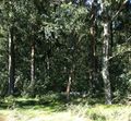
The hash is located in a little wooded area on the edges of Ålstorp, Sweden.
Participants
Erik r (talk), going solo this time
Plans
I'm on vacation here in Sweden, staying with family, and checked the hash coordinates the night of the seventeenth. I found they were just a few kilometers away from our place in Löddeköpinge, so I figured I'd bike there in the morning and be back in time for a late morning fika with the family.
Expedition
This one went without a hitch! Obviously I didn't bring my trusty Trek bike to Sweden (not so trusty given my first hash attempt but hey) so, Johan Johansson being home (what your bike doesn't have a name?) I used by grandfather's old cruiser. It was an easy ride up through Lödde, past a friend's plant nursery, and through a few little towns to the hash point. It was a beautiful late summer's day, and a nice morning ride. Quite windy though, which was a bit tough on the return trip. Anyway, I got there around 10:35, having left a bit after 10:00, and followed my phone to a little wooded area near a track where some people were on morning jogs or walks. As usual I haven't got a GPS device, rather expensive as they are, so Google Maps on the phone had to do but I'm pleased enough that I reached the spot. Anyway, at that point I took my photos, had a nice (windy) ride back, and that was it!
Photos
Achievements
Erik_r earned the Land geohash achievement
|
Erik_r earned the Bicycle geohash achievement
|
Erik_r earned the Globetrotter achievement
|


