Difference between revisions of "2015-10-17 51 10"
imported>Fippe (new expedition) |
imported>Fippe (→Expedition) |
||
| Line 3: | Line 3: | ||
|lon = 10 | |lon = 10 | ||
|date = 2015-10-17 | |date = 2015-10-17 | ||
| − | |graticule_name = | + | |graticule_name = Harz |
| − | |graticule_link = | + | |graticule_link = 51,10 |
}} | }} | ||
| Line 17: | Line 17: | ||
==Expedition== | ==Expedition== | ||
| − | ''to | + | I got to Oker by train. Because I am stupid, I went there in the evening and the twilight had already started. However, I started walking up the mountains. After dusk, I used my flashlight to find the way. |
| + | |||
| + | At [https://maps.google.com/?q=51.877515,10.480425 some point], I was supposed to turn right. However, there was no path to my right. I went a bit forward, and a bit back, and didn't find anything. So I went back even further and found something that might be the path, so I went that way. After a while, it turns out that it wasn't a path, but I continued. I went down the hill, crossed a very thin stream and then went up the hill. This sounds easy, but it was dark and I'm glad I made it. | ||
| + | |||
| + | I was back on the path now. It wasn't really a path though, more like “well, all the other possibilities certainly aren't the path”. After continuing to walk, I finally arrived at the coordinates, which were right on the “path”. | ||
| + | |||
| + | On the way back, I stayed on the “path”, which became more and more path-like. After a while, I arrived at the spot where I was supposed to turn right, and yeah, in hindsight, that was the path, but it wasn't very different from it's surroundings, so it was hard to make it out. Finally, I made it back to Oker, and from there, back to home. | ||
| − | |||
==Photos== | ==Photos== | ||
<gallery> | <gallery> | ||
| − | + | 2015-10-17 51 10 01 Oker.jpg | At the train station | |
| + | 2015-10-17 51 10 02 Oker.jpg | Coat of Arms of Oker | ||
| + | 2015-10-17 51 10 03 Landscape.jpg | Landscape in Oker | ||
| + | 2015-10-17 51 10 04 Tributary.jpg | A tributary of the river Oker | ||
| + | 2015-10-17 51 10 05 Goat Back Cliff.jpg | At the “goat back cliff” | ||
| + | 2015-10-17 51 10 06 Fern.jpg | Dinosaur food | ||
| + | 2015-10-17 51 10 07 Geohash.jpg | The Geohash | ||
| + | 2015-10-17 51 10 08 Proof.png | Proof | ||
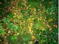
| + | 2015-10-17 51 10 09 Surroundings.jpg | Surroundings of the Geohash | ||
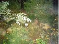
| + | 2015-10-17 51 10 10 Surroundings.jpg | ||
| + | 2015-10-17 51 10 11 Fippe.jpg | My face. Best picture ever. | ||
</gallery> | </gallery> | ||
| − | |||
| − | |||
==Achievements== | ==Achievements== | ||
{{#vardefine:ribbonwidth|700px}} | {{#vardefine:ribbonwidth|700px}} | ||
| − | {{land geohash|latitude=51|longitude=10|date=2015-10-17|name=[[User:Fippe|Fippe]]}} | + | {{land geohash|latitude=51|longitude=10|date=2015-10-17|name=[[User:Fippe|Fippe]]|image=2015-10-17 51 10 07 Geohash.jpg}} |
| + | {{minesweeper geohash|graticule=Kassel, Germany|ranknumber=4|nw=true|n=true|ne=true|e=true|name=[[User:Fippe|Fippe]]|image=Kassel.png}} | ||
{{minesweeper geohash|graticule=Hannover, Germany|ranknumber=5|e=true|s=true|w=true|nw=true|se=true|name=[[User:Fippe|Fippe]]|image=Hannover.png}} | {{minesweeper geohash|graticule=Hannover, Germany|ranknumber=5|e=true|s=true|w=true|nw=true|se=true|name=[[User:Fippe|Fippe]]|image=Hannover.png}} | ||
| Line 35: | Line 49: | ||
[[Category:Expeditions]] | [[Category:Expeditions]] | ||
[[Category:Coordinates reached]] | [[Category:Coordinates reached]] | ||
| + | [[Category:Expeditions with photos]] | ||
Revision as of 16:07, 20 October 2015
| Sat 17 Oct 2015 in Harz: 51.8748105, 10.4796840 geohashing.info google osm bing/os kml crox |
Location
The Geohash is located in a forest near Oker in the Harz Mountains.
Participants
Plans
Get to Oker by train, then walk about 4km to the coordinates.
Expedition
I got to Oker by train. Because I am stupid, I went there in the evening and the twilight had already started. However, I started walking up the mountains. After dusk, I used my flashlight to find the way.
At some point, I was supposed to turn right. However, there was no path to my right. I went a bit forward, and a bit back, and didn't find anything. So I went back even further and found something that might be the path, so I went that way. After a while, it turns out that it wasn't a path, but I continued. I went down the hill, crossed a very thin stream and then went up the hill. This sounds easy, but it was dark and I'm glad I made it.
I was back on the path now. It wasn't really a path though, more like “well, all the other possibilities certainly aren't the path”. After continuing to walk, I finally arrived at the coordinates, which were right on the “path”.
On the way back, I stayed on the “path”, which became more and more path-like. After a while, I arrived at the spot where I was supposed to turn right, and yeah, in hindsight, that was the path, but it wasn't very different from it's surroundings, so it was hard to make it out. Finally, I made it back to Oker, and from there, back to home.
Photos
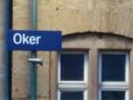
At the train station
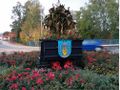
Coat of Arms of Oker
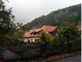
Landscape in Oker
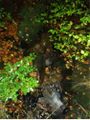
A tributary of the river Oker
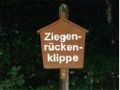
At the “goat back cliff”
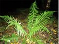
Dinosaur food
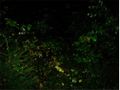
The Geohash

Proof
Surroundings of the Geohash
- 2015-10-17 51 10 11 Fippe.jpg
My face. Best picture ever.


Achievements
Fippe earned the Land geohash achievement
|
Fippe achieved level 4 of the Minesweeper Geohash achievement
|
Fippe achieved level 5 of the Minesweeper Geohash achievement
|