Difference between revisions of "2015-10-25 63 28"
imported>Pastori (Created page with "{{meetup graticule | lat=63 | lon=28 | date=2015-10-25 }} __NOTOC__ == Location == In Koppelo, Valtimo. The point lies in an area called Konikangas, on a well-kept, mossy are...") |
imported>FippeBot m (Location) |
||
| Line 38: | Line 38: | ||
[[Category:Expeditions with photos]] | [[Category:Expeditions with photos]] | ||
[[Category:Coordinates reached]] | [[Category:Coordinates reached]] | ||
| + | {{location|FI|13}} | ||
Latest revision as of 05:35, 15 August 2019
| Sun 25 Oct 2015 in 63,28: 63.7027747, 28.5575544 geohashing.info google osm bing/os kml crox |
Location
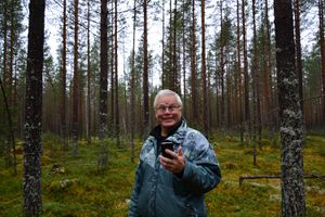
In Koppelo, Valtimo. The point lies in an area called Konikangas, on a well-kept, mossy area of pine trees.
Participants
- Pastori
- The Wife
Expedition
Today's hashpoint was so close to home, in the neighbouring village, that it fell into the category of ”must visit”. So, Pastori and Wife set off early in the morning with their hashpoint gear. They drove for 10,5 kilometres on a sand road and walked for a 100 metres on a very easy terrain of soft, mossy area of pines. And there the point was at an accuracy of 0,8 metres. After a picture together Pastori and Wife returned to the car while Pastori was trying to find his favourite mushroom available at late autumn, the Yellowfoot (craterellus tubaeformis). He didn't find any. They did however bring home some fresh air in their lungs and the whoosh of the wind in the trees in their ears. It was a nice hour long trip in +7 degrees Celsius into an autumnal forest and then back home to eat.
Additional photos
Achievements
Pastori & The Wife earned the Land geohash achievement
|


