Difference between revisions of "2015-12-31 49 8"
imported>Sourcerer m (→Achievements) |
imported>DODO (→Achievements) |
||
| Line 59: | Line 59: | ||
== Achievements == | == Achievements == | ||
{{#vardefine:ribbonwidth|800px}} | {{#vardefine:ribbonwidth|800px}} | ||
| + | |||
| + | {{land geohash | ||
| + | | latitude = 49 | ||
| + | | longitude = 8 | ||
| + | | date = 2015-12-31 | ||
| + | | name = DODO | ||
| + | }} | ||
| + | |||
| + | {{bicycle geohash | ||
| + | | latitude = 49 | ||
| + | | longitude = 8 | ||
| + | | date = 2015-12-31 | ||
| + | | name = DODO | ||
| + | | distance = 26 KM | ||
| + | }} | ||
[[Category:Expeditions]] | [[Category:Expeditions]] | ||
[[Category:Expeditions with photos]] | [[Category:Expeditions with photos]] | ||
[[Category:Coordinates reached]] | [[Category:Coordinates reached]] | ||
Revision as of 17:07, 10 July 2016
| Thu 31 Dec 2015 in 49,8: 49.4139590, 8.4243446 geohashing.info google osm bing/os kml crox |
Location
In a wet grassland south of Neuhofen.
Participants
Plans
Go there by bike in the morning. To close, not to go.
Expedition
I had to prepare the dessert for the dinner, so I couldn't start before 1 pm. But it was raining in the morning anyway.
It was just a quick 12 kilometer ride to Neuhofen. There was a path between a dogs club and a farm with horses. Behind the dogs club was a ditch and a dense cops (blackberries), but behind that was a wide and wet grassland. I left my bike at the fence of the farm and walked into the grass. That was very wet - on the one hand because the ground was wet anyway, on the other hand because it had rained all morning. After 100m into the grass I reached the hash, took some pictures and walked back to my bike.
I rode the same way back and reached home less than one and a half hour after I left.
Tracklog
Photos
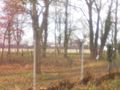
the fence of the horse farm
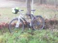
where I left my bike
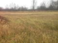
view to the hash (100 m)
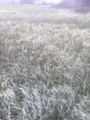
through wet grass
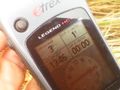
proof
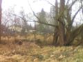
view to the north (dogs club house)
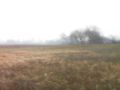
view to the south-west
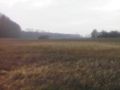
and the south-east

happy hasher


Achievements
DODO earned the Land geohash achievement
|
DODO earned the Bicycle geohash achievement
|