Difference between revisions of "2016-02-19 49 11"
imported>Danatar ([live] Coordinates reached! Finally, after 3 months of withdrawal. I'm now back at the car, where I left my phone. Now onward!, to skiing, report will follow next week.) |
imported>Danatar (Report!) |
||
| Line 1: | Line 1: | ||
| − | + | {{meetup graticule | |
| − | |||
| − | |||
| − | |||
| − | |||
| − | |||
| − | |||
| − | |||
| − | |||
| − | |||
| − | {{meetup graticule | ||
| lat=49 | | lat=49 | ||
| lon=11 | | lon=11 | ||
| date=2016-02-19 | | date=2016-02-19 | ||
| − | }} | + | | graticule_name=Nürnberg |
| + | | graticule_link=Nürnberg, Germany | ||
| + | }}__NOTOC__ | ||
| + | == Location == | ||
| + | |||
| + | Today's location is in a field near Hauendorf, not far from Entmannsberg and Bayreuth. | ||
| − | + | Country: Germany; state: Bayern (Bavaria, EU:DE:BY); district: Bayreuth rural district | |
| − | |||
| − | + | Weather: clouded | |
| − | |||
| − | |||
| − | |||
| − | |||
| − | == | + | == Expedition== |
| − | + | ===[[User:Danatar|Danatar]]=== | |
| − | + | In order to go skiing with friends, I first had to pick up one of those friends (including ski equipment) in Pegnitz. And after a long long time without any nearby/interesting/schedule-compatible hashpoints I was glad to find one not far off the route. Instead of leaving the Autobahn A9 at the Pegnitz exit, I already left it at the Bayreuth-South exit, then I followed the B22 federal road for a bit. At Lehen ("fief") I turned into a smaller country road and then I was already near the hashfield. There was a small patch of tarmac next to an intersection where I could park the car. There were already growing small plants (young corn?) in the field, so I first set out to walk around the field, with a small detour to a lake. While I was walking along the field's edge I saw five deer running across a field further away. They ran across the road that I had just taken, luckily there was no car at the time. Once I had walked halfway around the hashfield I carefully walked along one of the tire tracks where no plants were growing. It was very muddy. I had estimated well and the hashpoint was right on that tire track. | |
| − | |||
| + | After the usual pictures I walked back to the edge of the field, getting even more mud all over my shoes. It was a bit difficult to get even the majority of the mud off. With only a short stop in the next village (there was a sign that advertised in-house-produced honey, but they were closed) I continued to Pegnitz. We put the skiing equipment in my car and drove to Oberstdorf. When I was walking into the newly-built appartment we had rented for the weekend, many lumps of dried mud fell off my shoes. Oops. | ||
| − | |||
| − | |||
| − | |||
| − | |||
| − | |||
| − | |||
| − | |||
| − | |||
| − | |||
| − | == | + | {{gallery|width=200|height=200|lines=2 |
| − | + | |Image:2016-02-19_49_11_near.jpg|almost there | |
| − | + | |Image:2016-02-19_49_11_gps.jpg|GPS | |
| + | |Image:2016-02-19_49_11_spot.jpg|the hashpoint | ||
| + | |Image:2016-02-19_49_11_hp.jpg|coordinates reached | ||
| + | |Image:2016-02-19_49_11_pano.jpg|panorama | ||
| + | |Image:2016-02-19_49_11_rehe2.jpg|two deer running (one is male) | ||
| + | |Image:2016-02-19_49_11_rehe3.jpg|three other deer crossing the road | ||
| + | |Image:2016-02-19_49_11_see.jpg|lake near the hashpoint | ||
| + | |Image:2016-02-19_49_11_bus.jpg|bus stop next to the hashfield | ||
| + | }} | ||
| − | |||
| − | |||
| − | |||
| − | |||
| − | |||
| − | |||
| − | |||
| − | + | ===tracklog=== | |
| + | [http://www.everytrail.com/view_trip.php?trip_id=3409899&code=9cc0bd801f060018fc303e58112161d0 Triton tracklog] | ||
| − | |||
[[Category:Expeditions]] | [[Category:Expeditions]] | ||
| − | |||
[[Category:Expeditions with photos]] | [[Category:Expeditions with photos]] | ||
| − | |||
| − | |||
| − | |||
| − | |||
| − | |||
[[Category:Coordinates reached]] | [[Category:Coordinates reached]] | ||
| − | + | [[Category:Danatar]] | |
| − | |||
| − | |||
| − | |||
| − | |||
| − | |||
| − | |||
| − | |||
| − | |||
| − | |||
| − | |||
| − | |||
| − | |||
| − | |||
| − | |||
| − | [[Category: | ||
| − | |||
| − | |||
Revision as of 19:15, 10 March 2016
| Fri 19 Feb 2016 in Nürnberg: 49.8882346, 11.6570762 geohashing.info google osm bing/os kml crox |
Location
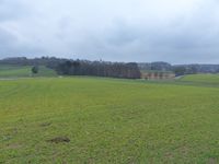
Today's location is in a field near Hauendorf, not far from Entmannsberg and Bayreuth.
Country: Germany; state: Bayern (Bavaria, EU:DE:BY); district: Bayreuth rural district
Weather: clouded
Expedition
Danatar
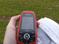
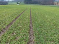
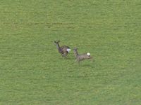
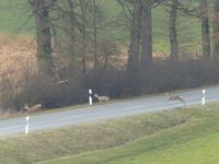
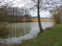
In order to go skiing with friends, I first had to pick up one of those friends (including ski equipment) in Pegnitz. And after a long long time without any nearby/interesting/schedule-compatible hashpoints I was glad to find one not far off the route. Instead of leaving the Autobahn A9 at the Pegnitz exit, I already left it at the Bayreuth-South exit, then I followed the B22 federal road for a bit. At Lehen ("fief") I turned into a smaller country road and then I was already near the hashfield. There was a small patch of tarmac next to an intersection where I could park the car. There were already growing small plants (young corn?) in the field, so I first set out to walk around the field, with a small detour to a lake. While I was walking along the field's edge I saw five deer running across a field further away. They ran across the road that I had just taken, luckily there was no car at the time. Once I had walked halfway around the hashfield I carefully walked along one of the tire tracks where no plants were growing. It was very muddy. I had estimated well and the hashpoint was right on that tire track.
After the usual pictures I walked back to the edge of the field, getting even more mud all over my shoes. It was a bit difficult to get even the majority of the mud off. With only a short stop in the next village (there was a sign that advertised in-house-produced honey, but they were closed) I continued to Pegnitz. We put the skiing equipment in my car and drove to Oberstdorf. When I was walking into the newly-built appartment we had rented for the weekend, many lumps of dried mud fell off my shoes. Oops.
|
