Difference between revisions of "2016-04-09 59 18"
imported>Cjk |
imported>Sourcerer m (→Fixed New report status) |
||
| Line 71: | Line 71: | ||
== Achievements == | == Achievements == | ||
{{#vardefine:ribbonwidth|800px}} | {{#vardefine:ribbonwidth|800px}} | ||
| − | |||
| − | |||
| − | |||
| − | |||
| − | |||
| − | |||
| − | |||
| − | |||
| − | |||
| − | |||
| − | |||
| − | |||
| − | |||
[[Category:Expeditions]] | [[Category:Expeditions]] | ||
| − | |||
[[Category:Expeditions with photos]] | [[Category:Expeditions with photos]] | ||
| − | |||
| − | |||
| − | |||
| − | |||
| − | |||
[[Category:Coordinates reached]] | [[Category:Coordinates reached]] | ||
| − | |||
| − | |||
| − | |||
| − | |||
| − | |||
| − | |||
| − | |||
| − | |||
| − | |||
| − | |||
| − | |||
| − | |||
| − | |||
| − | |||
| − | |||
| − | |||
| − | |||
| − | |||
Revision as of 15:52, 14 June 2016

| Sat 9 Apr 2016 in 59,18: 59.6579399, 18.1496916 geohashing.info google osm bing/os kml crox |
Location
In the woods near Gottröra, Sweden.
Participants
Plans
Test drive my new car.
Expedition
I was testing my new BMW and I open the droid it app and todays has was doable. Headed past Arlanda airport and off to the right fields. Turns out the hash was in a pine forest and they had been good at clearing out weeds so it was really open and easy to get to. 250m or so from the road.
- Hash -- Cjk (talk) @59.6580,18.1497 16:55, 9 April 2016 (GMT+02:00)
Headed back to the car and took a different way home. Had to stop at a rune stone on the way. It says:
Finnvid erected this stone after his brother Tord, the son of Tjävle. God help his spirit and God's mother. He built this bridge after his brother, and Åsa, their mother.
Tracklog
Photos
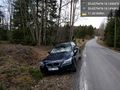
New car @59.6579,18.1495
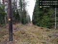
That way @59.6579,18.1498
Looking back @59.6579,18.1497
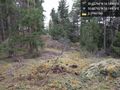
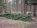
Fallen tree @59.6579,18.1497
Spring flowers @59.6579,18.1497
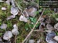
Deer poop @59.6579,18.1497

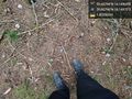
Me at hash @59.6580,18.1498
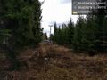
Trees @59.6580,18.1497
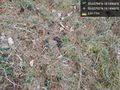
The hash @59.6580,18.1497
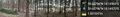
The panorama @59.6580,18.1497
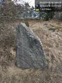
Runestone @59.6007,18.2112
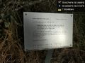
Plaque @59.6007,18.2112


