Difference between revisions of "2016-04-28 51 9"
From Geohashing
imported>GeorgDerReisende (new report) |
imported>GeorgDerReisende (expedition report for Göttingen-Herberhausen) |
||
| Line 1: | Line 1: | ||
| − | |||
| − | |||
| − | |||
| − | |||
| − | |||
| − | |||
| − | |||
| − | |||
| − | |||
| − | |||
{{meetup graticule | {{meetup graticule | ||
| lat=51 | | lat=51 | ||
| Line 19: | Line 9: | ||
== Location == | == Location == | ||
| − | + | ||
| + | The hash lay at the edge of some allotments in Göttingen-Herberhausen. | ||
== Participants == | == Participants == | ||
| − | + | ||
| − | + | [[User:GeorgDerReisende|GeorgDerReisende]] | |
== Plans == | == Plans == | ||
| − | + | ||
| + | I wanted to hitchhike to Göttingen, then I wanted to take the bus 92 to Herberhausen, then walking. | ||
== Expedition == | == Expedition == | ||
| − | |||
| − | |||
| − | |||
| − | |||
| − | == | + | {| |
| − | + | |- | |
| − | Image: | + | ! style="width:300px" | !! style="width:300px" | !! style="width:300px" | |
| − | -- | + | |- |
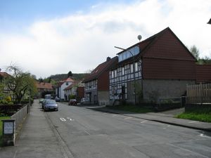
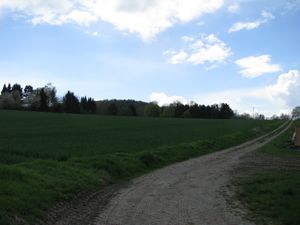
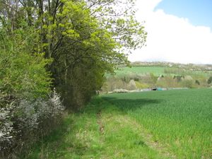
| − | + | | [[Image:2016-04-28 51 9 GeorgDerReisende 1569.jpg | 300px ]] || [[Image:2016-04-28 51 9 GeorgDerReisende 1582.jpg | 300px ]] || I started to hitchhike at Kassel and after some minutes a car stopped and I got a lift right to the junction to Herberhausen at the B 27. Two kilometers to hash. I walked through the village and arrived at the field, behind there was the hash. | |
| − | + | |- | |
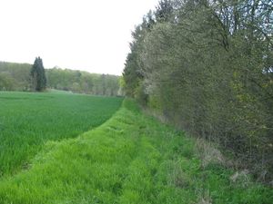
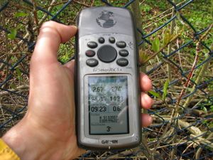
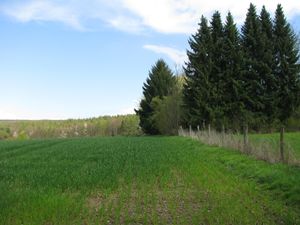
| + | | [[Image:2016-04-28 51 9 GeorgDerReisende 1586.jpg | 300px ]] || [[Image:2016-04-28 51 9 GeorgDerReisende 1595.jpg | 300px ]] || According to the town map of Göttingen the way between the field and the trees should a public fieldway. And it was easy to walk. Arriving at the hash I noticed a fence between me and the hash. I needed a lot of tries to get an appropriate result. Dancing to a fence with bushes in front of it. For a moment I had a five meter result, but at the end I had a stable three meter result. | ||
| + | |- | ||
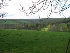
| + | | [[Image:2016-04-28 51 9 GeorgDerReisende 1597.jpg | 300px ]] || [[Image:2016-04-28 51 9 GeorgDerReisende 1601.jpg | 300px ]] || And I looked around: to the north and to the east. | ||
| + | |- | ||
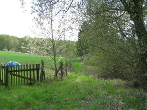
| + | | [[Image:2016-04-28 51 9 GeorgDerReisende 1602.jpg | 300px ]] || [[Image:2016-04-28 51 9 GeorgDerReisende 1604.jpg | 300px ]] || To the south and to the east, to the east some meters away for a better view. | ||
| + | |- | ||
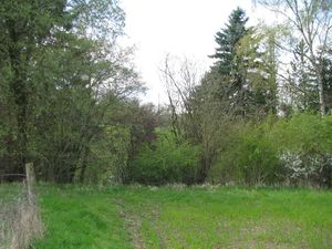
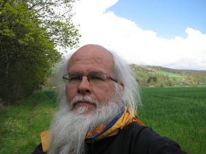
| + | | [[Image:2016-04-28 51 9 GeorgDerReisende 1603.jpg | 300px ]] || [[Image:2016-04-28 51 9 GeorgDerReisende 1616.jpg | 300px ]] || The geohasher of this hash. After hash I walked to the city of Göttingen and viewing back, I had a not very good view to the hash area. The hash behind the trees, but not to see. | ||
| + | |} | ||
== Achievements == | == Achievements == | ||
| Line 45: | Line 41: | ||
<!-- Add any achievement ribbons you earned below, or remove this section --> | <!-- Add any achievement ribbons you earned below, or remove this section --> | ||
| − | + | {{Thumbs Up | latitude = 51 | longitude = 9 | date = 2016-04-28 | name = GeorgDerReisende }} | |
| − | |||
| − | |||
| − | + | [[Category:Expeditions]] | |
| − | |||
| − | [[Category: | ||
| − | |||
| − | + | [[Category:Expeditions with photos]] | |
| − | |||
| − | |||
| − | |||
| − | |||
| − | |||
| − | |||
| − | |||
| − | |||
| − | |||
[[Category:Coordinates reached]] | [[Category:Coordinates reached]] | ||
| − | |||
| − | |||
| − | |||
| − | |||
| − | |||
| − | |||
| − | |||
| − | |||
| − | |||
| − | |||
| − | |||
| − | |||
| − | |||
| − | |||
| − | |||
| − | |||
| − | |||
| − | |||
Revision as of 19:56, 28 April 2016
| Thu 28 Apr 2016 in 51,9: 51.5355529, 9.9962233 geohashing.info google osm bing/os kml crox |
Location
The hash lay at the edge of some allotments in Göttingen-Herberhausen.
Participants
Plans
I wanted to hitchhike to Göttingen, then I wanted to take the bus 92 to Herberhausen, then walking.
Expedition
Achievements
GeorgDerReisende earned the Thumbs Up Geohash Achievement
|
