Difference between revisions of "2016-05-22 52 1"
From Geohashing
imported>Sourcerer (→Planning) |
imported>Sourcerer m ([live picture] Arrived. [http://www.openstreetmap.org/?lat=52.51988947&lon=1.43009484&zoom=16&layers=B000FTF @52.5199,1.4301]) |
||
| Line 26: | Line 26: | ||
<gallery perrow="5"> | <gallery perrow="5"> | ||
| + | |||
| + | Image:2016-05-22_52_1_Sourcerer_1463954798697.jpg | Arrived. [http://www.openstreetmap.org/?lat=52.51988947&lon=1.43009484&zoom=16&layers=B000FTF @52.5199,1.4301] | ||
</gallery> | </gallery> | ||
Revision as of 22:08, 22 May 2016
| Sun 22 May 2016 in Norwich, UK: 52.5199110, 1.4301409 geohashing.info google osm bing/os kml crox |
Location
A field south of Seething and Mundham, Norfolk, UK.
Participants
Plans
Expedition
Photos
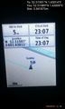
Arrived. @52.5199,1.4301

Achievements
Expeditions and Plans
| 2016-05-22 | ||
|---|---|---|
| Pforzheim, Germany | Someone went | Eq H EW t,. -- Elimik31 (talk) @49.0149,8.4107 15:45, 22 May 2016 (GMT+02... |
| Norwich, United Kingdom | Sourcerer | A field south of Seething and Mundham, Norfolk, UK. |
Sourcerer's Expedition Links
2016-05-21 52 0 - 2016-05-22 52 1 - 2016-05-23 52 1 - KML file download of Sourcerer's expeditions for use with Google Earth.